Hello everyone. Before we get onto the three day forecast, I just want to reflect on the upcoming storm on Wednesday. We are currently under a Winter Storm Warning until midnight Wednesday. I think there could be a Blizzard warning as the day progresses Wednesday.
Here is my analysis:
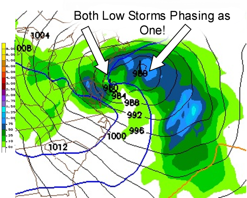
Right now, there are two pieces of energy (or as common folk call them, storms!) in the midwest. As these two systems propel east by the jet-stream, they will phase together as one super large low pressure system off the New Jersey coast come Wednesday morning. Because of the significant phasing, the “nor-easter” will pretty much stall in the Atlantic for a few hours.
I have an image of what the phasing will look like according to the NAM weather model:

Now, to the forecast
Tonight: Clear Skies and very cold, Low 14
Tomorrow: Increasing Clouds as the day progresses. Hi 32
Tomorrow Night: Snow Likely Overnight. Accumulations of 4-6 inches. Low 25
Wednesday: Snow winds down as two systems phase in the morning. Snow picks up heavy in the afternoon. Blizzard conditions possible. Additional snow accumulations of 6-10 inches. Hi 29
Wednesday Night: Heavy snow in the evening (1 to 2″ per hour rates?), then winding down overnight. Low 20
Thursday & Thursday Night: Clearing out with a partly cloudy sky. Hi 31 Low 17

Kool
indeed kool.