Hi everybody. I’m sorry for the lack of updates recently, I feel I have let my readers down. 😦
Ok let’s get to the weather. I have been telling a few classmates at school this past week about a snowstorm/pseudo-blizzard that will hit next Monday (December 13th). I am extremely excited about the latest computer model run from today showing our area getting 12-15 inches of snow Sunday night into Monday night.
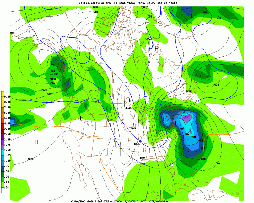
18z GFS computer model, at 216 hours (Around 4 PM Monday afternoon):
This model run is very important for the future of this storm. Many experts have been calling this storm for the past week hence the reason I have been informing a few of my classmates about it. This is the first model run from the GFS that is showing a full-fledged storm hitting our area. We have a negative NAO (North American Oscillation) predicted for that time frame. Negative NAO values generally indicate some kind of low pressure crossing the country or a nor easter. The large rainstorm we just had earlier this week made the NAO values tank. What intrigues me about the December 13th storm is the abundance of cold air that will be in the area during that time frame. The last storm didn’t have enough cold air associated with it hence the reason we received a ton of rain.
For this upcoming storm, everything is seeming to fit together perfectly, which doesn’t happen too much in the weather world. We got neg NAO, cold air, a storm system, and some model agreement 9 days out.
On a more serious note, weather is very unpredictable; we are relying on a bunch of computers to predict the future. There is always room for this storm to be a bust.

