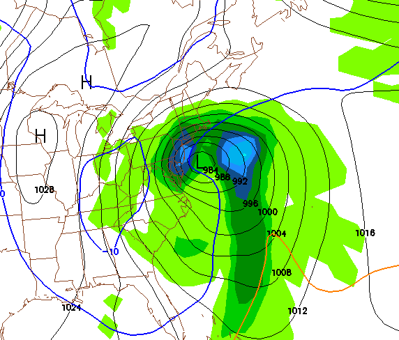
Well, this storm has really been quite challenging for many weather forecasters and enthusiasts alike. The weather models have been all over the map for this storm, switching from an out to sea scenario to a big coastal storm. I have great news for snow lovers (like myself). The GFS model, which many forecasters rely on for their predictions has been showing a large scale snowstorm for our area. Three straight runs have shown at least a foot of snow for most of the I-95 corridor.
As of right now however, the GFS is the only model that is showing this solution. I am still uncertain about the track of this storm and how much snow we are going to get. Therefore I will not make a snow map until most of the models are in some sort of agreement with each other.
Here is the blizzard scenario from the GFS:

