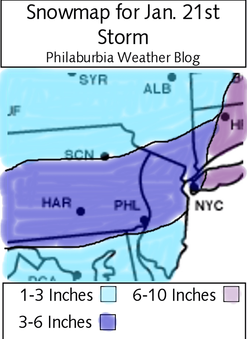
Hi everyone. I have finally come to a conclusion for the storm on Friday. Most models are agreeing with each other at this point and are generally showing a 3-6 inch solution for the area. Now, many of the news stations (aka my enemies) will be calling this storm with lower totals compared to what I’m predicting. I have put into account the super high snow ratios that are occurring in the Midwest right now (30:1) and make a logical prediction that these high snow ratios will continue as the storm passes to the south of us. A normal snow ratio is 10:1, meaning that 1 inch of rain will get 10 inches of snow. Because most models use liquid equivalent precipitation predictions, it is up to the weather geeks and meteorologists to decide what the snow ratio will be. If we do get 20:1 or 30:1 ratios (meaning 20 or 30 inches of snow per inch of rain) we will easily get 3-6 inches of fluffy snow.
So on to my official prediction: 3-6 inches of fluffy high ratio snow. Totals will be higher up to the northeast and lower to the southeast.
Time frame: Starting at around 1 AM Friday morning, ending in the late morning. Heaviest snow will fall during the 4-7 AM range.
Schools: Delays will be the most likely outcome. Closings, in my opinion, are really becoming less likely right now. I wouldn’t be surprised if a few schools do close, but most will have a delay if everything goes as planned (which it never does…).
Snow Map: Here’s the snow map. Pretty explanatory and simple compared to previous storms

Looking forward: Next Tuesday into Wednesday I will watch as a snow/rain/mix event is becoming more and more likely. February 1st and 2nd of the week after could see a storm as well.
