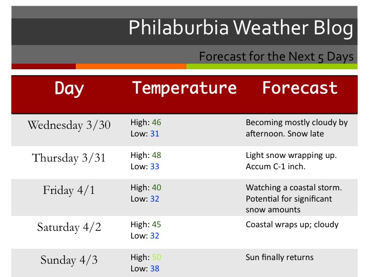
Here is my agenda for this post: 1. Talk about storm tomorrow night 2. Talk about the big one on April Fools Day 3. 5 day forecast
1. We will be getting a coating to an inch of snow, especially north and west of the city tomorrow night as a weak low pressure system passes to the south of us. Nothing to worry about with this system because nothing should stick to the roads whatsoever.
2. Now, for the Friday storm. I have been talking about this one for a while now and it has finally started to shape out the way I had thought. The GFS model has generally been on board for a fairly major snowstorm Thursday Night into Friday. Other models have been showing a more rain and snow mix, which would lower our snow totals drastically. Right now I am leaning toward the snowier solution. My early call right now is for 4-8 inches to fall Thursday Night and Friday. There will be higher totals in higher elevations. The snow will be wet and heavy; power lines and trees have the risk of falling on Friday. Because we are still 3 days away from the storm I will not post a snow map just yet. And yes, there could be school closings on Friday.
Here is a projection from the GFS of the snow. This is at 5 AM Friday and will be most likely the most intense part of the storm:

And now the 5 Day Forecast:

Snow map and update tomorrow!!!
