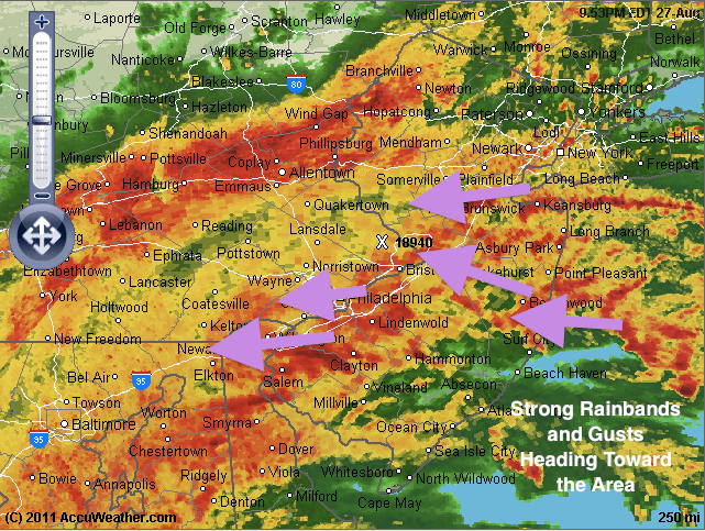
Update 10 PM: The rain and wind has really picked up around the area as strong rainbands are sweeping around the hurricane. There are a few Tornado Warnings around the area, and I would recommend to stay tuned to the local news for the latest updates on the Tornadoes. The rain and wind should continue to intensify into tomorrow morning. Stay safe everyone!

Hi everyone. Not too much change for Irene’s path or strength. One thing to note, however, is Irene’s pressure and strength. Right now she is a category 1 hurricane, but her central pressure is 952 mb. This pressure would normally be equivalent to a category 3 hurricane. What this means is that Irene’s hurricane force winds extend extremely far from her center. As a result, many people will see category 1 gusts in our area.
And finally I have posted some live maps and radars of Irene as she heads up the coast for everyone’s convenience:


