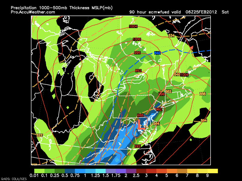
Temperatures will climb into the 60s for the rest of the week as a Bermuda high (normally seen in the summer months) sets up to our southeast. Wednesday should be the nicest of the week with sunny skies and temperatures in the 60s. On Thursday, a string of weak disturbances will move through, making for damp, dreary, and warm conditions. By Friday night, we are looking at a potential large storm coming just west of the area. This westerly track means we will be on the “warm side” of the storm, and our precipitation will be in the form of rain. After this storm moves through, windy and cooler conditions will take over for the weekend.
Here is the European model at 1 AM Saturday showing heavy rain and warm temperatures:

Next week will be fairly quiet until later in the week and weekend. A storm system has the potential to affect the area either Thursday, Friday, or Saturday next week. Details about this storm are vague, but it could have the potential to bring in enough cold air to support snow. Once again, because the NAO and AO are still positive, it will be tough for a storm to wrap up and ride the coast. My gut feeling is that the storm will suppress to our south, much like the one this past weekend.
