
As I mentioned a few days ago, a minor shortwave clipper system is passing over the region today and will drop a quick coating on places north and west of the city. Looking at the current radar, some dynamic cooling is occurring where snow is falling in Maryland, causing temperatures to fall as much as six degrees in places. By 6 PM, precipitation will start falling in the Philly area and will likely change to snow for a time. Things should start ending by midnight and skies will clear by Christmas morning.
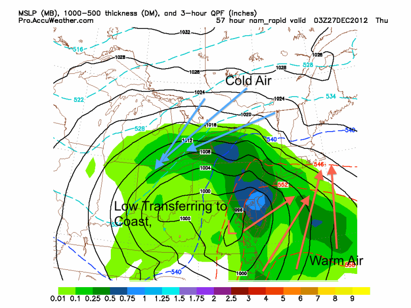
At this point, it looks like the storm on Wednesday the 26th and Thursday the 27th will be primarily rain. Most models are in consensus and are showing a strong low cutting up the Appalachians. The storm will eventually transfer to the coast, but it will be far too late to bring in the arctic air aloft to support snow for the Delaware Valley. As a result, the precip type in this storm will primarily be rain, heavy at times. There is a chance for some snow on the backside of the storm Thursday morning, but I would not expect any accumulation.
Our active pattern will continue as another storm is possible next Saturday into Sunday. The European forecast model has been showing a coastal low bringing us some decent snow totals, while the GFS model has been showing the storm out to sea. More details will emerge for this storm as the week progresses.
