The active weather pattern continues. The post-christmas storm proved to be a large rain and wind maker for our area. Snow reached a foot over much of Northern New York and Western Pennsylvania. There was an unexpected burst of snow at the beginning of the storm for areas north of Philadelphia, which created some slippery conditions on the roads during the afternoon hours. By the evening, the warm sector of the storm took over and temperatures rose above 32 degrees.
Our next storm will affect the area on Saturday. This will likely be an all snow event, with the low pressure being much weaker than the last. There are two possible tracks for this next storm. The GFS model shows a storm that hugs the coast and drops 3-5 inches of snow for much of the I-95 corridor. The NAM weather model projects the storm sliding south and out to sea. Totals would be 1-2 inches in this scenario.
Here is the GFS at 2 PM Saturday:

The NAM shows a much weaker solution, due to the distance the low pressure is from the coast:

Timing and Effects:
Snow should start falling by mid morning in most places. Snow could get heavy by 2 PM, and should start to slow down by 8 PM on Saturday. Roads should be a little dicey in the afternoon, and icing could occur at night. Keep it slow on the roads on Saturday and Saturday night.
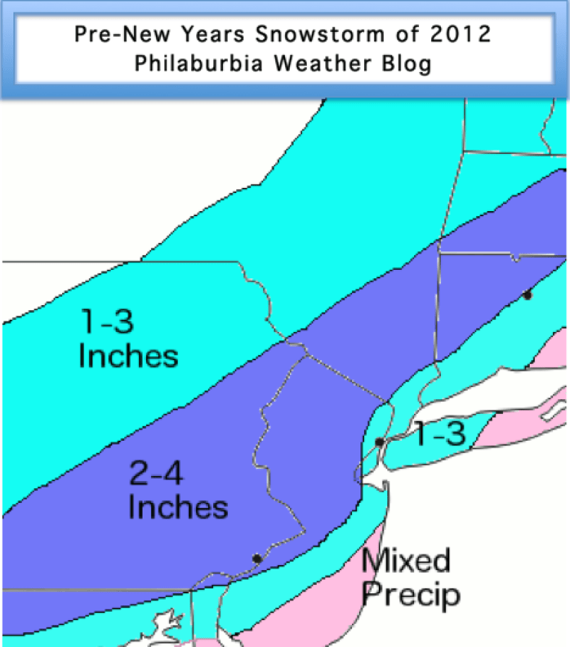
Snow Map:
I am a bit conservative on my totals for Saturday’s storm. I call for 2-4 inches for most of the Delaware Valley. In Central PA, Southern NJ, and NYC, I have 1-3 inches. By the shore, temperatures will be too warm to support snow accumulation.

