
Wow. It was quite the day meteorologically yesterday. After many forecast models were showing minimum snow falling in the Delaware Valley, Philadelphia International ended up with 8.6 inches of snow. Many areas to the south and west of the city received 4-8 inches of snow with some isolated totals nearing a foot! Unfortunately, many people were not expecting a major snowstorm to occur. As a result, many accidents were reported on major roadways. December can be a very tricky month to predict snowstorms, as we are still transitioning to a classic winter pattern.

Another, more predictable snowstorm is in the works for tomorrow. The system is a weak piece of energy associated with the trough that is pulling through the area as we speak. The snow will be short and intense. The snow will start around 9 AM on Tuesday and end by 7 PM on the same day. In localized areas, snow could fall at an inch or two per hour. The tricky part of this forecast is determining the exact position of the trough when the moisture runs the coast. Unfortunately, this part of the forecast is subject to “nowcasting”, which means it is impossible to predict which areas will receive the most snow until the storm is actually occurring.

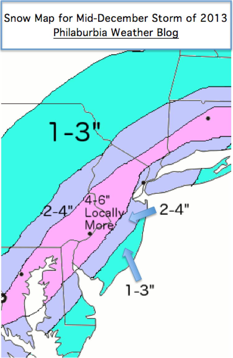
Luckily, most models are in agreement that we will receive a general 3-6 inches in the Philadelphia metro area, with lower totals in the outskirt suburbs. Temperatures should hover around 32, and roads should be salted before the storm arrives. A Winter Storm Warning has also been released by the National Weather Service for the whole I-95 corridor.
With that said, here is my first snow map of the 2013-2014 winter. Enjoy!
Another storm is on-deck for early next week, so stay tuned!

Right on target, Jason. As usual.