
The active weather pattern of February 2014 continues. A large nor’easter will affect most of the East coast from Wednesday night until late Thursday night, bringing strong winds and heavy precipitation to the Eastern seaboard. The question that remains is whether the precipitation will stay as all snow, or mix during the storm.
Part 1: Difficulty of the forecast
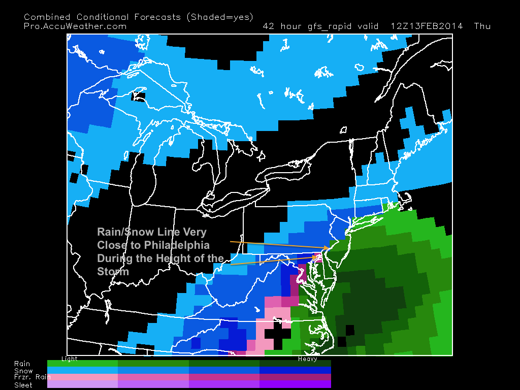
Forecasting this storm for the Philadelphia region has been far from easy. The amount of cold air in the upper atmosphere is unremarkable, which means that the rain/snow line will be very close to the city, with areas in south Jersey likely turning to rain sometime during the day on Thursday. The storm track will be key as it runs up the coast and strengthens.
If the storm is closer to the coast, more ocean influenced warm air will be present aloft and mixing issues will occur for areas close to the city. A storm closer to the coast also means more precipitation, which could offset the mixing issues that we would have from the storm. If the storm is further from the coast, more cold air will be present aloft, but precipitation values will be lower than they would be if the storm retrograded near the coast. Conclusively, it seems like each path has its pros and cons concerning precipitation type and amount. In the image below, the blue dotted line shows the projected rain/snow line. Note this is only a projected value.

Lastly, many models have trouble projecting exact upper air patterns when a storm of this magnitude runs up the coast. Many times, storms this strong produce their own cold air, and many places expecting mixing issues stay below freezing.
Part 2: My Preliminary Forecast and Timing
My belief at this point is that this storm will be strong enough to keep areas around the Philadelphia region and just south all snow, which would maximize snow totals. I do believe that south Jersey and any areas close to the ocean will mix at some point during the storm. This will hold down totals in these areas.
There is a catch, however. Many models have been showing a more westerly track recently, and I still am not ready to release a snow map to the public. Even 24 hours before the storm, there is still lots of uncertainty on the track and how much mixing will occur along I-95.
What is certain is the timing of this storm. The snow should start early Thursday morning and peak during the morning on Thursday. Things should start to slow down by Thursday evening, with precipitation ending by 10 PM on Thursday for most areas.
The effects of this storm will be great with or without mixing. Most schools will be closed on Thursday. Roads will be dangerous and I recommend to stay home regardless of the precipitation type.
I will be updating tomorrow with an official snowmap and my final forecast. Stay Tuned.
