
After a quick warmup on Monday, winter is back with a vengeance tomorrow with our first snowstorm of the season. There have been a few changes since I posted yesterday Morning.
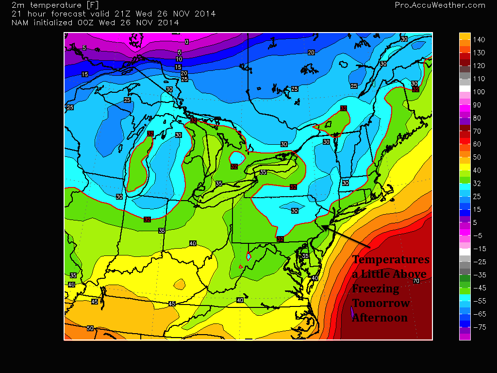
Firstly, surface temperatures will be hovering at or a little above freezing for most of the day tomorrow. This, combined with warm upper air temperatures, will cause the snow to mix with rain initially before changing to snow later in the day. Areas further north should expect an earlier changeover, while most of South Jersey may not see a complete changeover to snow during the storm.
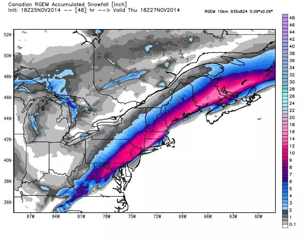
Since it is still November, forecasting snow totals for this storm is extremely difficult. The most recent short-run models have been favoring a more west track. This means less snow for the region than originally expected. My snow map shows 2-4 inches falling in the city with 3-5 inches in the immediate northern and western suburbs. If the storm takes a more westerly track like the short-run models are showing, these totals could fall substantially.
This map below shows an example of how a small shift in the track could affect snow totals. A 10 mile shift west or east in the storm track is the difference between 8 inches of snow and none at all in Philadelphia.
Timeframe:
- 4-6 AM Wednesday: Light Rain Enters from South to North.
- 6-10 AM: Rain becomes heavier and turns to snow Philadelphia northward.
- 10 AM-5PM: Becoming all snow from northwest to southeast. Heavy at times. Possible thundersnow in spots.
- 5 PM-8 PM: Snow becoming lighter
- 8PM-11 PM: Snow moves out from south to north
Finally, I will release my first snow map of the season. This map is based on a combination of multiple computer models I have analyzed over the past few days. If you have any questions or concerns regarding the map, please let me know in the comments.

Be safe everyone. Remember that this snow will be of the wet and heavy variety, which means sporadic power outages and downed trees around the region. Until next time…

Fine snow map, Jason, making it easier to see what’s coming. Well done!