
Hi all, hope everyone had a nice weekend. A complex and extremely difficult to forecast inverted trough will form tomorrow, creating snowy conditions tomorrow afternoon into Wednesday morning.
The setup:
As of Monday morning, an extremely powerful low pressure system is moving up the coast, affecting areas of New England. As this low pressure moves away, a clipper will enter the area late tonight and transfer it’s energy off the coast. As this transfer occurs, a rare phenomenon known as the Norlun Trough will form. The trough is an interaction between the weakening low pressure in Ohio and western PA and the strengthening one off the coast. The North American Model depicts this interaction in the 500mb image below:
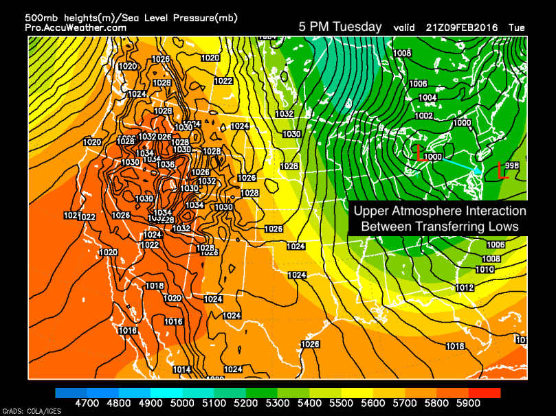 Referring to the image above, the Norlun Trough will likely setup somewhere along the turquoise arrow I drew to illustrate the interaction between the lows.
Forecasting the Trough:
I will be completely honest here: the Norlun Trough is a forecaster’s nightmare. The models have been historically bad at determining the location of the trough, since we still do not completely understand the atmospheric factors that drive the transfer of energy between the low pressures. That being said, from the data and information I have, it is looking likely that the trough will setup a little south of Philadelphia.
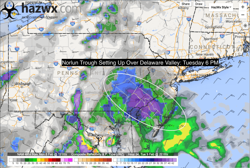 The NAM 4KM is one of the better short range simulated radar models. As you can see in the above image, the trough parks itself over the area for a prolonged period of time tomorrow evening into early Wednesday morning. Even though the event is a little over 24 hours away, there is still lots of uncertainty to where the trough will setup. If the interaction occurs 100 miles south or north, no snow would fall in Philadelphia.
My forecast:
For areas north of the city, less snow will fall: 2-4 inches
For areas West and South of the city, more substantial snowfall is likely: 4-8 inches
There will also be banding during this storm, meaning that there might be places that receive locally higher amounts in excess of 8 inches.
Stay tuned for updates.
