
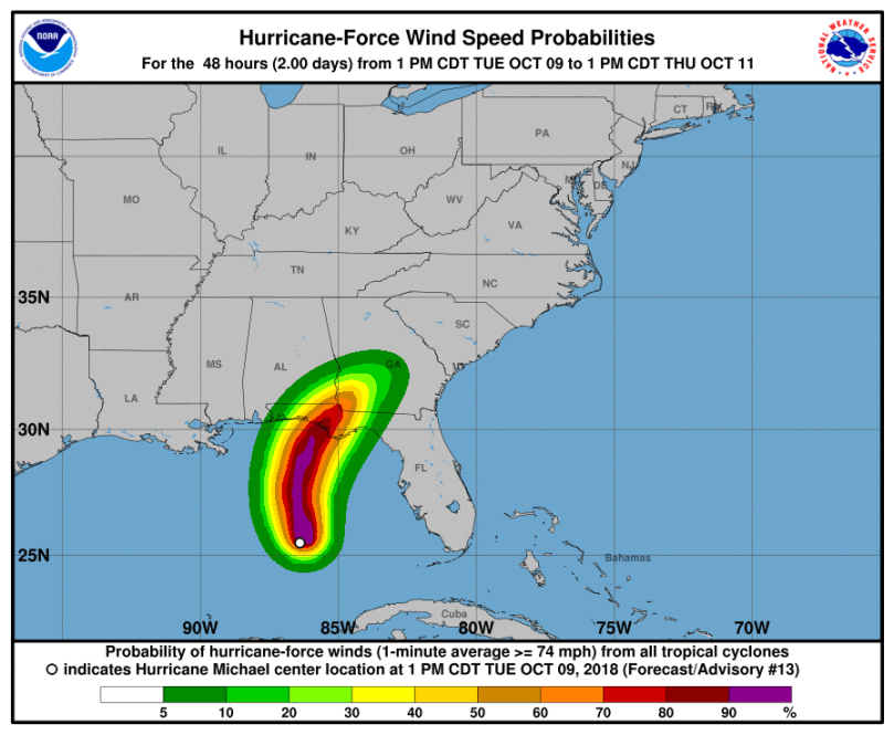
Hello all! Hurricane Michael is bearing down on the Florida panhandle with sustained winds of 120 mph (as of 8 PM Eastern). He is expected to slightly strengthen before making landfall on the Florida panhandle. Hurricane force winds will impact much of the panhandle, bringing destructive winds and storm surge along the coast:
Michael continues to move northward at a steady clip. His eye structure remains well formed and there is ample convection around the center of circulation, shown in the satillite loop below:

Most global and hurricane models are in agreement with Michael’s track. After making landfall, the storm will get picked up by the active jet stream and move northeast. Major flooding is likely to occur in the Carolinas into Virginia. The Delaware Valley could see 1-2 inches of rain from Michael, with much of the rain falling Thursday into Friday.
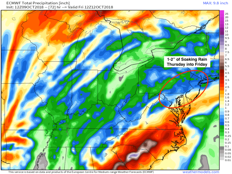
The amount of precipitation will depend on how quickly Michael gets picked up by the jet. If the interaction is later, Michael will track further north, bringing flooding rains to our area. If the interaction occurs earlier, then we will avoid the worst of the rains. A southern track looks more likely, sparing our area from additional rain and flooding.
Regardless of Michael’s impacts on the Philadelphia area, he will be an extremely destructive storm along the Florida panhandle. Stay safe!
