
Winter continues to stick around as we head into early March. A coastal low will develop tomorrow evening, bringing plowable snow to the I-95 corridor. While this season has been besieged by multiple complex storm systems, tomorrow’s storm is a fairly standard nor’easter from a meteorological perspective.
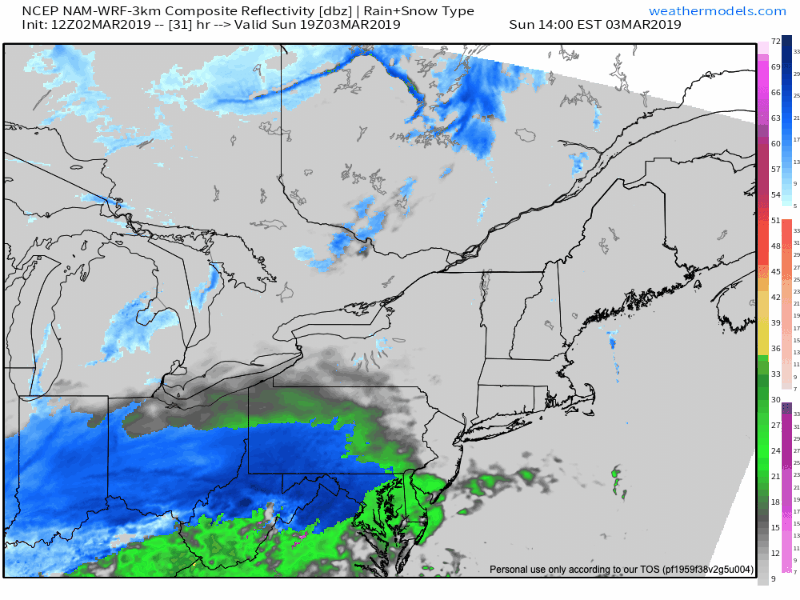
Currently, our storm is moving across the Rockies into the Plains. By tomorrow morning, a large swath of snow will develop over the midwest. As the storm moves east, it will intensify and move off the coast. In the southeast, there is a high risk of severe storms. Areas north will be impacted by snow (rain in coastal regions):

Without significant blocking to the north, this storm is a fast mover. Precipitation will commence in the Delaware Valley by 5 PM tomorrow and end by 3 AM Monday morning. The GIF below illustrates the storm’s quickness:
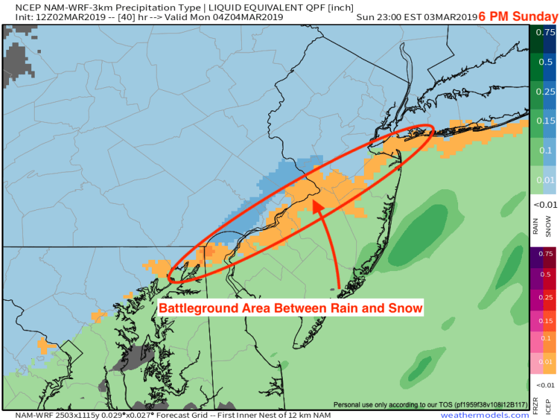
In areas south of I-95, precipitation will mainly fall as a cold, nasty rain. Philadelphia will likely be a battleground between rain and snow. Areas north and west of the city should stay as all snow for a majority of the storm:
Impacts
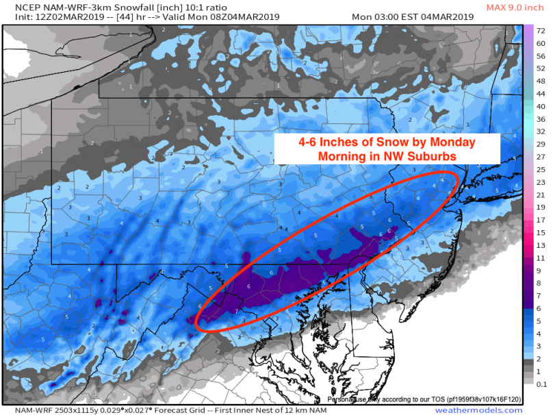
Monday’s rush hour will be impacted in the northern and western suburbs. When most people wake up on Monday morning, 4-6 inches of snow will be on the ground. Frigid air will follow the storm, which will slow down any melting until late next week.
Next Week
One last arctic blast will plunge temperatures 20 degrees below normal next week. Unseasonably cold weather will continue into next weekend and into mid-March. Based on long-range model runs, we should return to normalcy by the end of the month.
