Extreme Heat Coming This Week


Hi everyone. Even though been a while since my last post, I will continue to update the blog as we head into the dog days of summer and beyond.

Our area is currently under an Excessive Heat Warning, which is in effect from Wednesday afternoon through Friday night. This heat wave will be fueled by a strong Bermuda high sitting off the Atlantic coast. Temperatures will be in the high 90s and could reach 100 or hotter in some urban areas. The heat indices for Wednesday to Friday will climb near 105 degrees A cold front will sweep through the area on Friday night. Temperatures should moderate into next week before another we heat up again by July 1st.
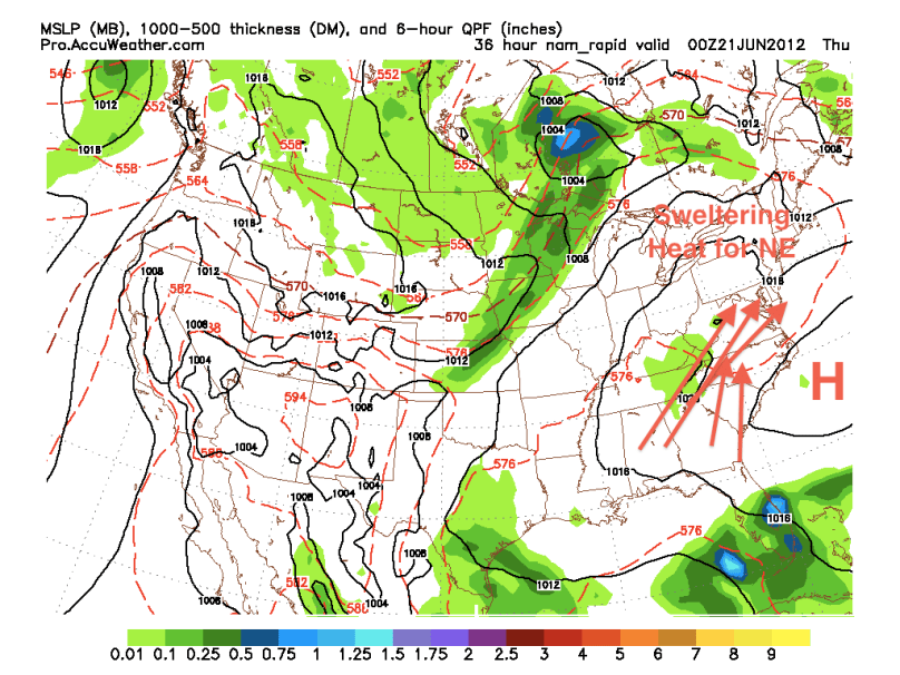
Sweltering Heat


The tropics have been quiet. There have been a few disturbances over the past few weeks that had a small chance to turn into tropical cyclones. None, however, have really turned into anything of note.

The El Niño is starting to take over and it is looking like it will continue to dominate into next Spring and Summer:

El Niño into next summer

Bad Severe Outbreak Today; Extremely Humid and Hot


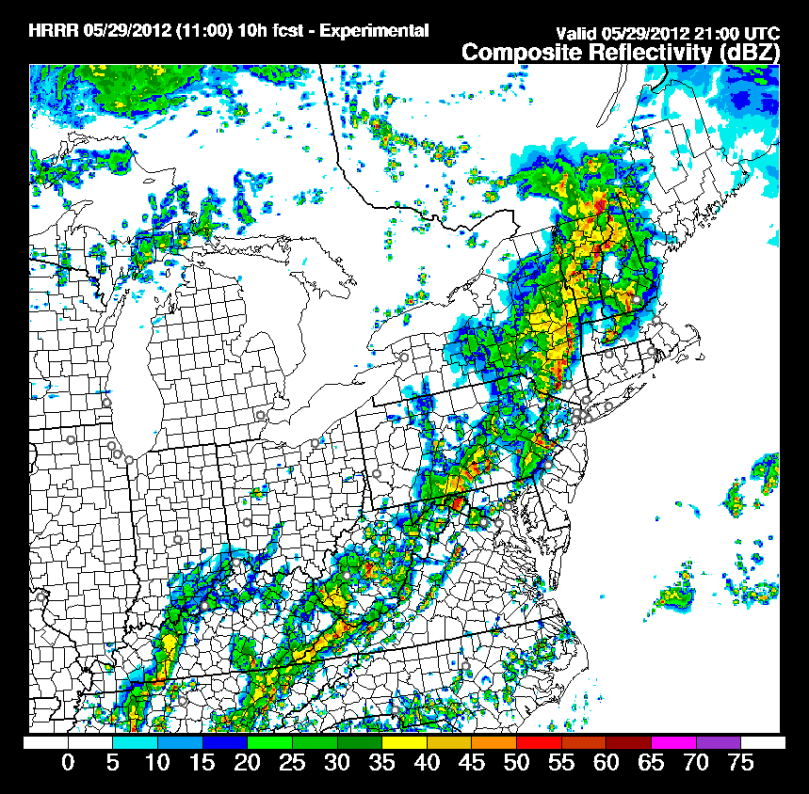
Hi everyone. I unfortunately was not correct on yesterday’s forecast. After calling for scattered strong storms, most of the day stayed completely sunny and very humid. We will, however, pay the price for yesterday’s nice weather. Because there were not any thunderstorms yesterday, the humidity levels have gotten higher from yesterday. CAPE values are astronomical for this afternoon, there is cold front ready to cross the region, and there is a ton of tropical moisture from Beryl. All of these factors signify a bad severe weather outbreak this afternoon. The Storm Prediction Center has placed us under a slight risk of severe weather, and I expect a Severe Thunderstorm watch to be issued later on.

The storms today will have hail, high winds, and even a small chance of some rotation (tornadoes) imbedded in the stronger ones. After the storms pass through today, humidity levels will drop and the rest of the week will be pleasant and more seasonable.

Simulated Radar 5 PM


Chance of Thunderstorms Everyday Into Next Week


We are in a classic summer pattern: instability in the atmosphere with a chance of thunderstorms everyday. There is also another tropical system brewing near Florida that could turn into our 2nd named system of the year. This weekend and next week will be hot as well. Remember to drink fluids if you are going to spend a prolonged period of time outdoors this weekend.

The 2012 Philaburbia Hurricane Forecast Video


Hey everyone,

After a short hiatus for AP tests, I am back with the weather videos. I talk about the exact numbers I am expecting this tropical season in the video. I also touch upon the nice weekend coming up and a little tropical development possible in a few weeks.

Enjoy!