Update on Isaac; Likely Into the Gulf


As I mentioned in my last post, Tropical Storm Isaac is bearing down on the US coastline. As of 11 PM EDT, Isaac is 65 miles south-southwest of Port Au Prince, Haiti, and is moving to the NW at 14 mph. Maximum sustained winds near the center of circulation are 70 mph, very close to category 1 hurricane strength. Minimum central pressure is 990 mb.
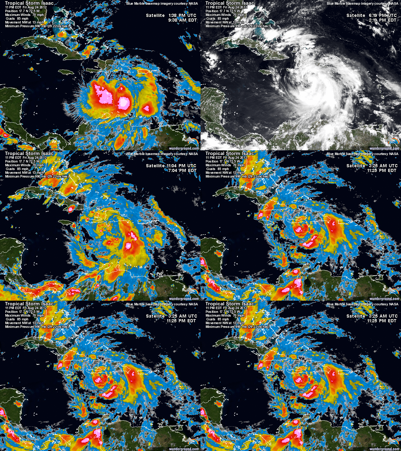
Current Isaac Satellite

The forecast models have been shifting east and west every run. Before Isaac crossed the Lesser Antilles, it seemed like an East Coast threat was possible. However, Isaac took more of a westerly path and is staying more south. Most models are in agreement about Isaac’s future path. They project Isaac strengthening into a Cat 2 storm and hitting somewhere between New Orleans and Tallahassee. The GFS model shows Isaac hitting Mobile, Alabama before getting absorbed by a frontal boundary moving east. The European model shows a similar solution but instead brings some of the remnants toward our area. The Canadian model is the outlier; it shows Isaac going east of Florida and into Georgia.
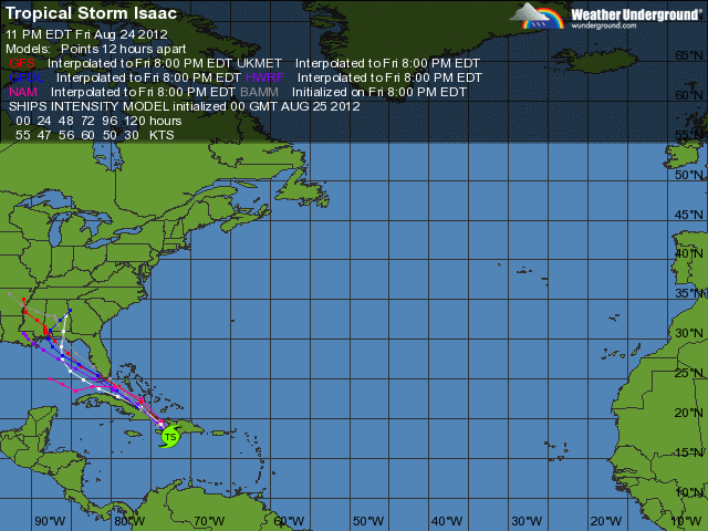
Model projections for Isaac

My forecast:

Over the past few hours, Isaac has taken a jog to the north. This can prove very crucial in future forecasts of Isaac’s track and strength. Because of this northward movement, I will still consider a track east of Florida possible. My official forecast however, brings Isaac north of Cuba into the Gulf of Mexico and hitting near Tallahassee, Florida. If our area is affected by Isaac late next week, there will likely be some drenching rain and some light winds. Other than that, it is looking to be a very interesting week for anyone living in Florida, Alabama, Mississippi, Louisiana, and Georgia.

IF the status of Isaac changes, I will post an update on the blog.


Advertisement

Tropical Depression 9/Isaac Will Threaten the East Coast Next Week


Hi everyone. As expected, the tropics are finally starting to become more active as we head into late August. I have been tracking a tropical wave located east of the Lesser Antilles for the past week or so. Just this morning, the National Hurricane Center upgraded the wave to a tropical depression (9). I imagine by tomorrow night, Tropical Storm Isaac will be born and will strengthen into a hurricane later this week.

The major debate associated with this storm is whether it will continue its westerly track and stay south of Hispaniola, Puerto Rico, and Cuba, or take a northward turn, becoming an Irene 2.0. Anybody living from Florida to New England should be watching this storm very closely. Isaac has many similarities to Irene position-wise and strength-wise. The high pressure setup is also favorable for a EC landfall as well.

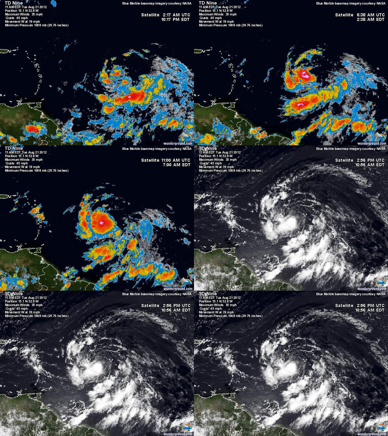
Current Sat of TD9

The Forecast Model Disco:

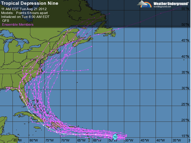
Many of the forecast models are showing Isaac moving south of Puerto Rico and Hispaniola, then taking a north turn toward Florida. Where Isaac makes the turn is becoming quite a debate between forecasters. Many of the models are disagreeing exactly where Isaac turns northward. The NAM is showing the turn over Hispaniola, while the GFS is showing the turn over Cuba.

The Importance of the Short-Range:

Even though it seems that most models are in agreement in the short-range, Irene proved to us that hurricanes seem to defy the forecast models especially during their strengthening phase.  Last August, Irene looked like she was going to stay south and head into Florida before turning NE out to sea. As Irene moved closer and closer to Puerto Rico and the Lesser Antilles however, a more northerly track looked likely; one that would affect the Eastern Seaboard.

Ensemble Models for Isaac


That’s the scare with TD9/Isaac. I am not confident in the track Isaac will take until he reaches the Lesser Antilles and Puerto Rico. Until then, I urge people to continue to stay with Philaburbia as I will be doing some video updates with model analysis over the next few days.