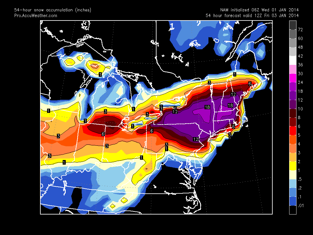
Hi everyone. It has been a very interesting 48 hours in terms of the next storm. It was just yesterday when we were looking at a very small clipper system barely affecting the region. Over the past day or two, things have taken a 180 and we are now looking at a major to significant snowstorm affecting most of the northeast.
The forecast models have been showing an Alberta clipper phasing with a piece of energy over the Carolinas later tonight. The resulting storm will amplify off the coast and quickly move northeast. Temperatures will be around 20 degrees, which means snow ratios will be high and salt on the roads will be basically ineffective. The map below shows the GFS model showing the storm strengthening over the Atlantic with heavy snows over the mid-atlantic. This shows the peak of the snow, which will occur from 3-9 PM.
Overall, the snow will start around 11 AM tomorrow and end late tomorrow night. The snow will be heavy for an extended period of time, which means that accumulations could be large in many locations. I wouldn’t be surprised to see some reports of 10+ inches in a few isolated areas. Most of the Delaware Valley will receive 6-9 inches with higher totals in the southern and eastern parts of the region. Travel will be horrible tomorrow for most of the day. Stay home.

After the storm pulls through, brutally cold arctic air will arrive. Temperatures will likely not get out of the 20s for the rest of the week, unfortunately. All in all, do not expect our snowpack to melt anytime soon.