Forecast and Upcoming RAINstorm


I hope everyone is enjoying the nice weather and seasonal temperatures over the past few days. I want to look ahead to our next storm system, which is looking to come next Tuesday or Wednesday. Forecast models have been showing a low pressure cutting through the Southeast and into the Northeast. Let me make it clear: this will not be a snowstorm! We just do not have the cold air and the sun angle for a snowstorm. After looking even further ahead, it looks like we won’t be even thinking about snow until after Thanksgiving.

Here is my forecast prediction of next week’s storm:

Preliminary Map for 17th Storm

And now for the forecast:

Friday: Sunny and warm High 60 Low 40

Saturday: High pressure in control High 61 Low 40

Sunday: Sunny in the morning, becoming partly cloudy by the afternoon High 62 Low 39

Monday: Partly to mostly cloudy becoming cloudy by the evening High 59 Low 41

Tuesday: Rain arriving in the morning High 60 Low 49

Advertisement

We Look to the Future


Hello everyone. As the title of this post says, we will be looking at what’s going on in the long range forecasts. For the next 9 days we will be having beautiful (and warmer) weather in the area as high pressure will rule for the most part to our north and south. As we head into next Wednesday however, a low pressure will form in the Gulf of Mexico. It will then cut through the southeast and dart northeast. This type of path is very similar to what we saw in some of the large noreasters last year.

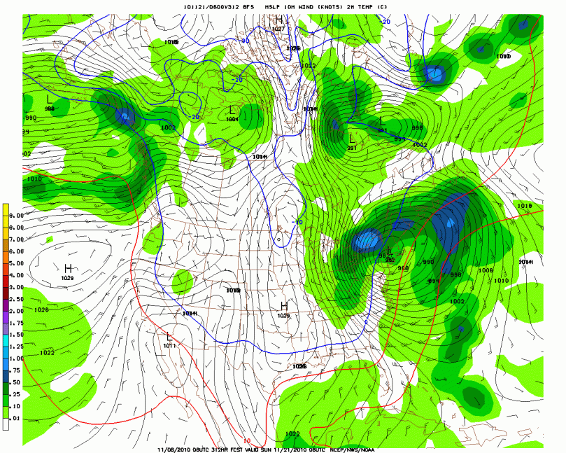
Now the storm after that is looking to hit on the Sunday or Monday before Thanksgiving. This storm has shown up on two straight GFS’ runs. This is extremely rare for a storm so far away to show up on two straight model runs. I do believe that there will be a storm around that time period but I have no idea who it will effect. These details will get ironed out as we get closer.

Future Long Range Storm

I will of course keep you updated on these two upcoming storms as time progresses. Otherwise enjoy your 9 days of nice weather, because it’s gonna get rough after that!

Just Drizzle for Thursday; Then Prolonged Nice Weather


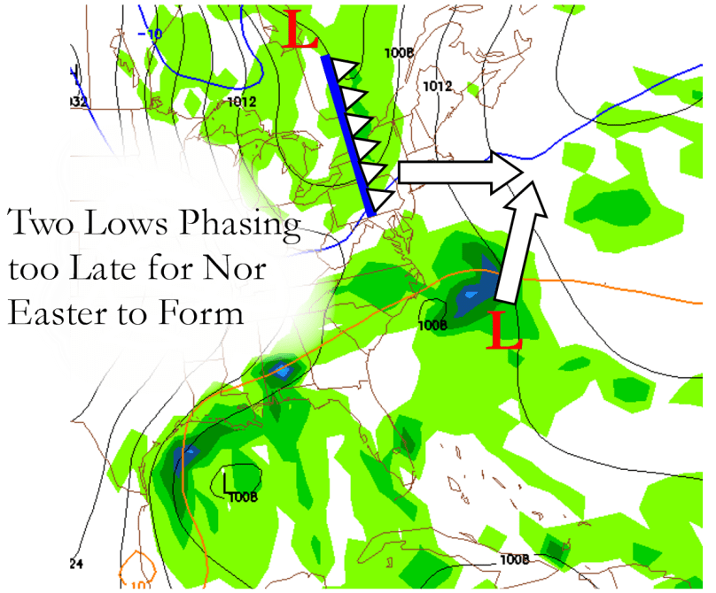
As it looks now from the latest computer models, the presumed “Nor Easter” that was expecting to arrive this coming Thursday will not be as much of a weather event as I had hoped. The two low pressure systems that were expected to phase (join together as one larger storm) before passing by our area are now looking as if they won’t join together until they pass north of the region. This would only give us cloudy skies and a few showers to accompany cool, raw temperatures.

Here is a map I made to illustrate why we won’t be dealing with a full-fledged Nor Easter this coming Thursday:


11/1/10 Storm


The rest of this week is looking to have highs in the 50s and lows in the mid to lower 30s. In the long-term, we are looking at a few storms that could give us some trouble later this weekend and into next week.

If any other details or changes arise from the upcoming storm, I will make sure to post them here. Otherwise have a nice night!