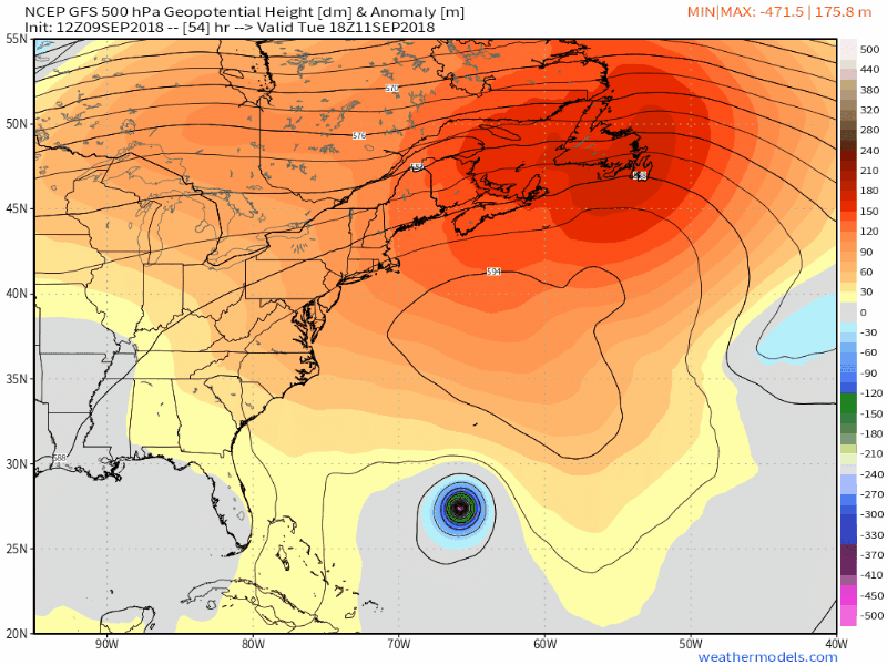
This has been quite a pattern. Last Friday’s nor’easter had distinctive characteristics of a hurricane (see image below) with wind gusts of 60-70 mph across the Northeast. Millions of households lost power, and many remain in the dark. It could take weeks for crews to fully clear damage from fallen trees and power lines.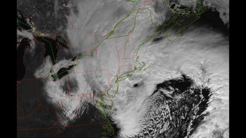 Snow totals were significant in upstate NY, with some areas receiving over 30 inches of snow! In the Delaware Valley, totals were very isolated: Bryn Mawr received 9.5 inches of snow, but Wynnewood (4 miles away) reported only 4 inches and Philadelphia 3 inches. Boston experienced historic storm surge, and hurricane force winds were reported in Washington DC. After a historic storm like this, most people do not expect additional threats for at least a few weeks. Unfortunately, mother nature is relentless and an active pattern will provide at least two more nor’easter threats over the next week. Strap in, because it’ll be a wild ride into mid-March.
Nor’easter: Round Two
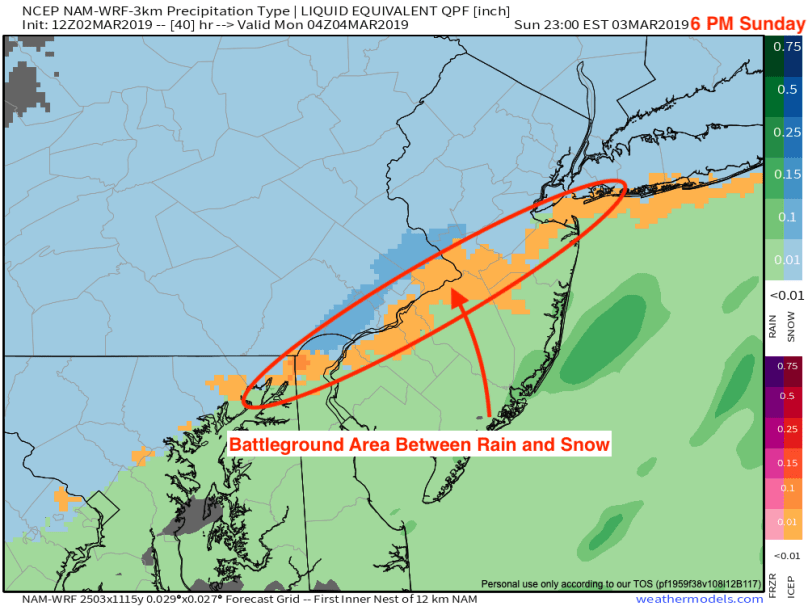
Only five days following the historic nor’easter last Friday, another coastal system will impact the Northeast with heavy snow and winds. While the meteorological setup is fairly similar to last week’s storm, there are a few differences. This system will move faster than the last one and will not produce the magnitude of wind we saw last week. There will also be more cold air in place as the nor’easter begins to strengthen. As a result, snow will be the primary precipitation type for our region (except for areas on the NJ coast). This combination of cold air and a strengthening coastal low-pressure system is a classic recipe for a major northeast US snowstorm.
Track and Timing
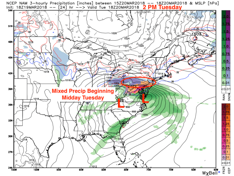
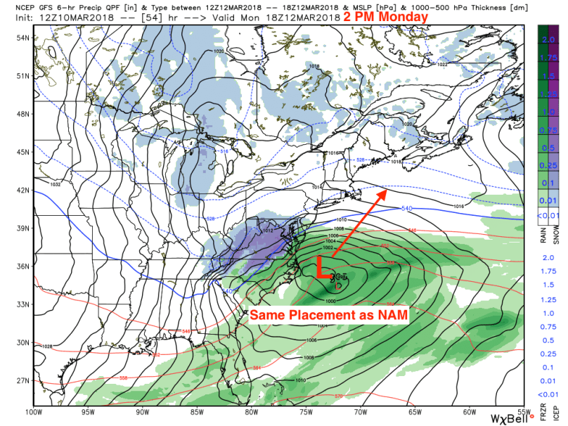
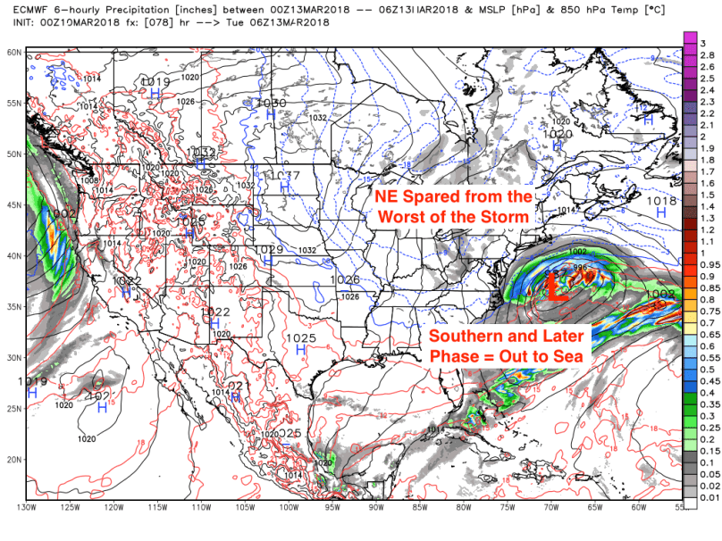
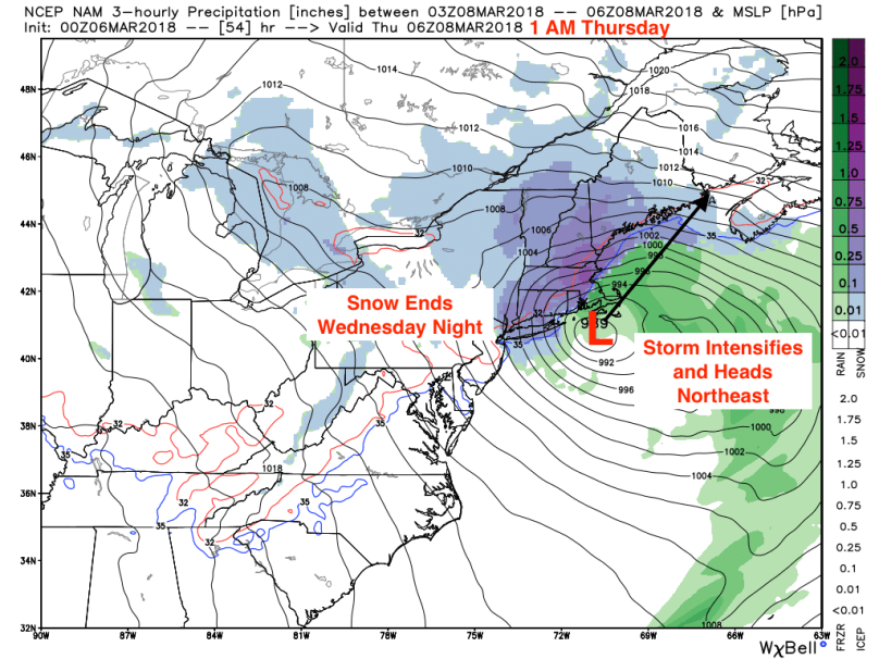
As with most nor’easters, the most prominent challenge for forecasters is determining the track. Currently, models are in decent agreement, with most showing a transfer of energy from a system moving east across the Ohio River Valley to a coastal disturbance off the Virginia coast. From there, the storm will begin to intensify and move northward, coming 50-100 miles from the NJ coastline:

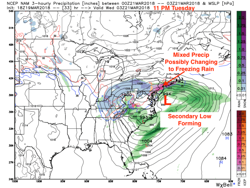
The storm will continue to strengthen as it moves northeast, moving out toward Maine reasonably quickly:
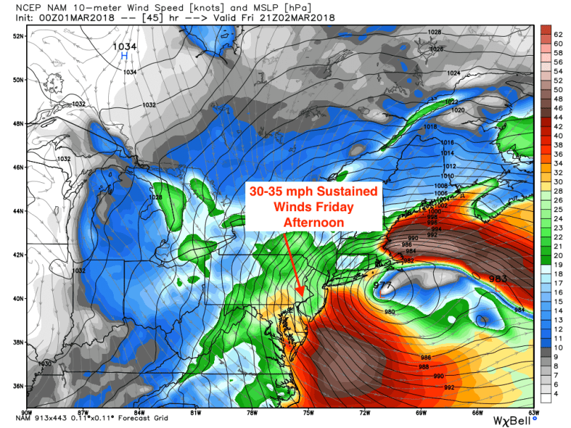
From start to finish, this will be close to an 18-hour event, with the most intense precipitation falling from 7 AM Wednesday to 4 PM Wednesday. Snowfall rates will reach 1-2 inches per hour during this period, and winds will gust to 40-45 mph. The overall timing will look like this:
- 10 PM Tuesday – 12 AM Wednesday: Light snow begins from South to North, mixing south of the Delaware River.
- 12 AM Wednesday – 7 AM Wednesday: Light to moderate snow continues, accumulating 1-3 inches by daybreak on Wednesday.
- 7 AM Wednesday – 4 PM Wednesday: Heavy snow moves in as storm intensifies, winds could reach 40-45 mph with visibilities near 0 at times.
- 4 PM Wednesday – 8 PM Wednesday: Snow moves out south to north. Precipitation will end everywhere by 10 PM on Wednesday.
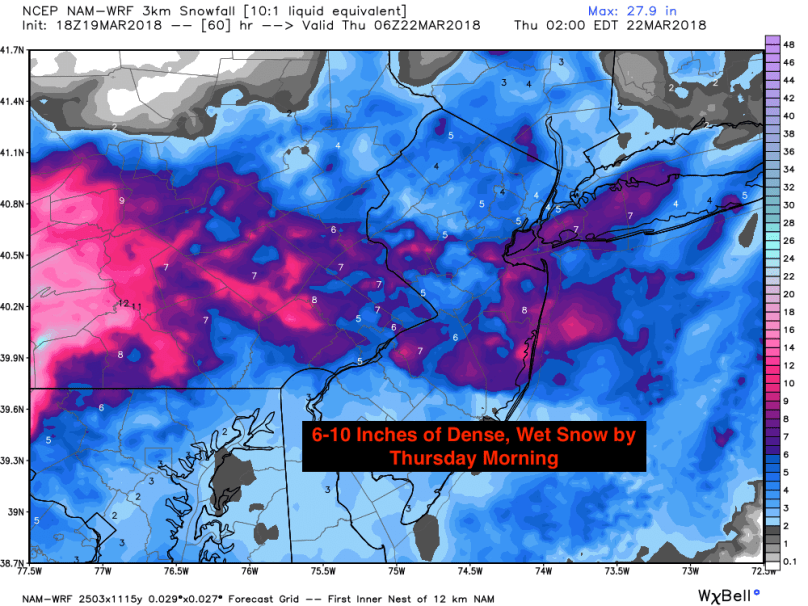
Final Snow Totals
This storm will bring significant snowfall accumulations to the I-95 corridor. While mixing concerns remain for areas south and east of the city, snow totals could be crippling in regions that stay all snow.
From a liquid equivalent perspective, forecast models have been showing 1.25-1.50 inches of “rainfall equivalent” falling from this storm:

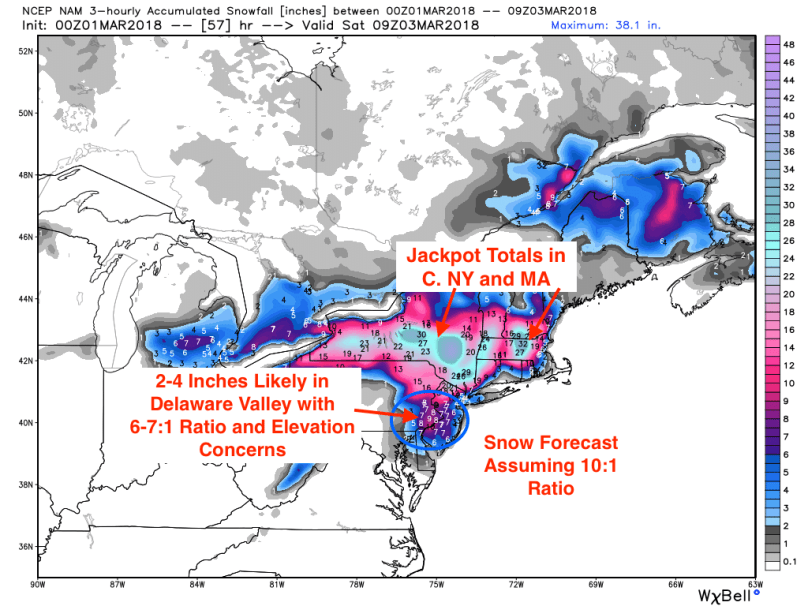
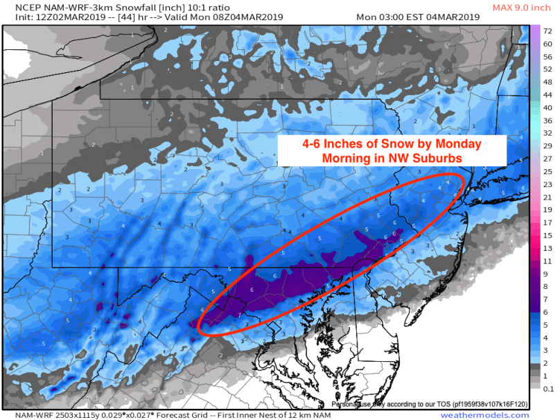
Taking into account a 10:1 snow to rain ratio, this would calculate to a 12-15 inch snowfall in areas north of the city:

With this particular storm, however, the snow will be heavy, wet, and therefore, less fluffy. This will bring down snow-to-rain ratios to around 7-8:1, calculating to maximum 10-13 inch accumulations. Note that maximum is bolded; banding tends to occur during storms like these, creating isolated areas of maximum snowfall with most people reverting to the mean. Taking this into account, below is my official snowfall forecast:
North and Western Suburbs (Bucks, Montco, Chester County, Central NJ): 8-12 inches with isolated totals of 14+ inches.
Philadelphia and immediate suburbs (Delco, Mercer Co., South Jersey): 4-8 inches, with pockets of 12+
Coastal Areas: 2-4 inches (mixing will suppress totals in areas close to the coast)
Final Thoughts
With heavy snow and strong winds, travel will be nearly impossible on Wednesday. Only drive if you absolutely have to; it’s not worth risking being stranded or hurt in a storm like this. Stay safe and enjoy the snow!
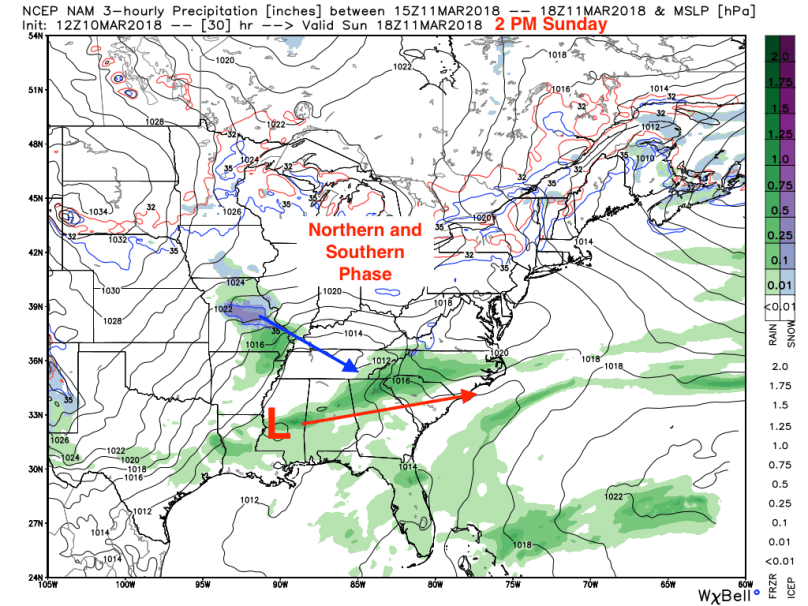
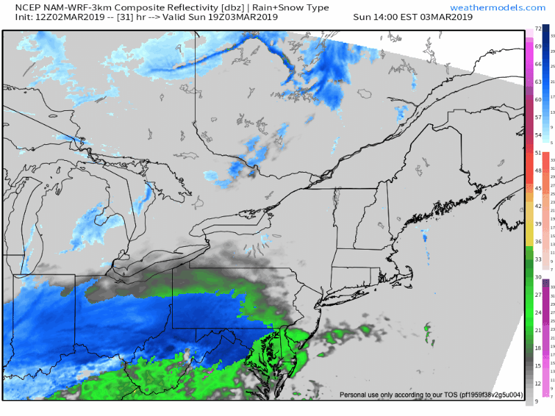
In a few days, I will likely be posting about Nor’easter Round Three, which looks like it will occur Sunday into Monday of next week.


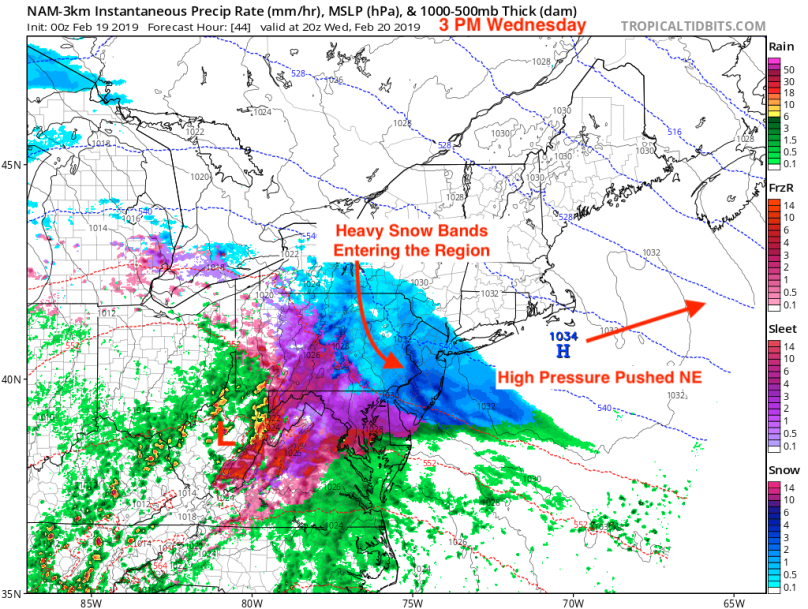


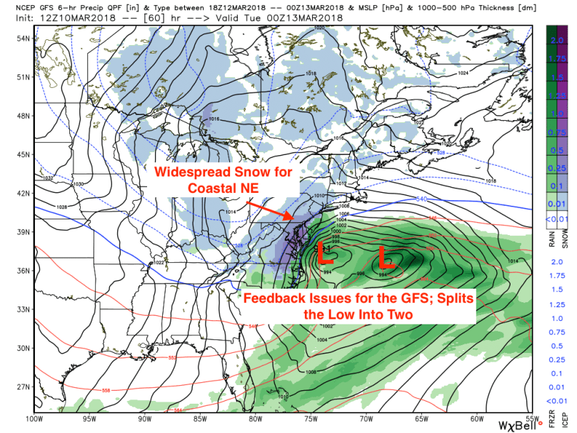
 The area of high pressure will be pushed eastward, setting up a cold flow from the north. This arctic air will fuel the west side of the storm, bringing a widespread area of wintry precipitation to the Northeast from Thursday into Friday.