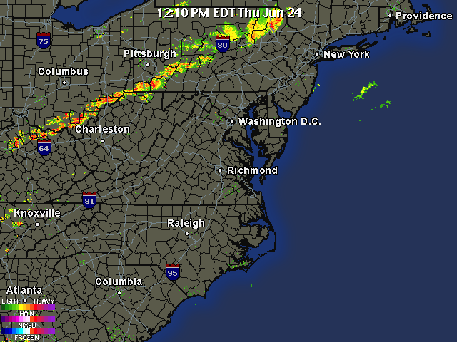
Update 12:30 PM: Okay, right after I published the last post, the NWS posted a Severe Thunderstorm Watch for the entire area until 8:00 PM. Expect the worst of the storms to pass through the area around 3-5 PM.
Here is the WRF simulated radar this afternoon; the storms will be scattered, but when they hit they will be severe:

As highs today reach the mid 90s, strong storms are forming in Central Pennsylvania right now. There is a Severe Thunderstorm Watch for that area right now, which will most likely be issued for our area by the mid-afternoon. The SPC placed the coverage area in a slight risk for severe weather and we are still under an excessive heat watch. The main threat for the thunderstorms today will be high, destructive winds. I wouldn’t rule out a few tornadoes popping up in places later today either. I will keep you updated throughout the day as these storms progress eastward.
Current position of storms as of 12:15:

REMEMBER TO CHECK THE RADARS PAGE FOR CONTINUOUS RADAR COVERAGE!
