
Hey everyone. The lack of posts for the past month have been partially my fault. College has been very time-consuming and it’s hard to find a time block to write a quality post. I am, however, taking a break from my studies to discuss the next storm coming this Friday and Saturday.
This will a big one. Two fairly strong systems will phase off the coast of NJ and create a large nor’easter with blizzard conditions from NYC to Boston. For the Delaware Valley, this will be a minor storm in terms of snow. The phase is occurring way too late and there will not enough cold air aloft for snow to fall. The graphic below shows the European solution at 1 PM Friday. This is right before the storms phase. As you can see, not enough cold air is available to support snow for the area (represented by the blue 540 line).

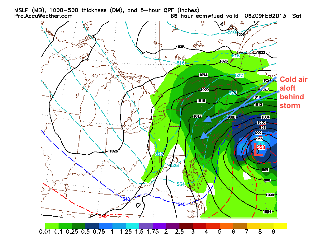
As the low pressures phase and strengthen, cold air aloft will eventually get wrapped around the storm. This will help change the rain to snow from north to south in the Delaware Valley, while creating blizzard conditions in New England.
The crucial component of this storm will be the timing of the phase. The slower the phase, the less snow for places south and west. If the phase occurs quicker than expected, then the changeover to snow could occur much sooner than the European model is showing above.
Timing-wise, rain should start falling Friday evening and changeover to snow early Saturday morning before trailing off. Snow totals are extremely difficult for the Philadelphia area because they rely completely on the phase timing. Right now I am calling for 3-5 inches to fall in the immediate Philadelphia area, with higher totals in Mercer county and upper Bucks. Overall, the consensus for the models is pretty good. The NAM model phases the low pressures much later, while the European and GFS phase it earlier. Over the next day, this disparity should disappear and a consensus should come. Until then…
