
Hey everyone. What makes predicting the weather so interesting is the unpredictability of it.
This is what has happened with the latest forecast models projecting possible Thanksgiving snowstorm. Yep. Nor’ Easters in November.
Lets get to it!
1. Tomorrow will likely reach into the 70s with some rain ahead of a strong cold front which will pass through on Monday night. I wouldn’t be surprised if the sun peaked out sometime in the afternoon. After the front moves through, temperatures will plunge throughout the day on Tuesday. This is shown below, courtesy of the GFS:
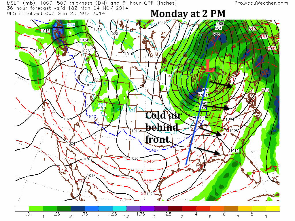
2. After the front moves through, a blocking high will move into Atlantic Canada, forming the setup for a storm to form along the coast. Another small disturbance will also move in from the midwest, phasing with the budding coastal system. This will really begin the process of a large storm forming on early Wednesday morning.

So the setup is there for a large snowstorm, but will it happen?
At this point, most forecast models are showing some sort of storm riding up the coast Wednesday into Thanksgiving. Since we are in November, the problem lies in whether there will be mixing during the storm. Upper air temperatures could be above freezing during the storm, especially if it runs close to the coast. This would bring in some wintry mix to the region at the beginning of the storm before changing to all snow.
On the other side, some models are showing dynamic cooling at the surface, which could keep the precipitation type all snow for the duration of the event.
Model differences:
GFS:
The GFS is showing a solution which would go further to the east. This solution I am supporting right now. In the end, the GFS projects a good 3-6 inches of heavy snow falling from DC to Boston. This will be enough snow to disrupt travel plans and create mass power outages (which is not good if you want to watch the Eagles game, like me). The maps below show the peak of the storm on Wednesday at 2 PM. Click the maps to see a larger version.

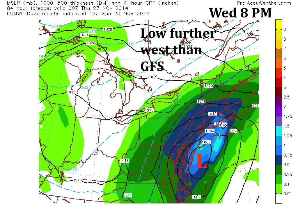
European:
The European model is projecting the storm to come further west near the coast. Since the storm is closer to the coast, temperatures at the surface will have trouble staying below or at 32 degrees. The upper air temperature will be above freezing as well, which could mean a mix of precipitation throughout the storm. Even though the Euro projects more total precipitation than the GFS, 3-6 inches would be a good estimate for final snow totals from this model. Below is the European model at 8 PM Wednesday night. Obviously it is a slower solution than the GFS, which means there is more time for the storm to strengthen.
So which solution is correct? Well the European ensembles show a solution more toward the GFS. The teleconnections are also marginal for a large nor’easter storm that retrogrades into the coast. As a result, my initial call is 3-6 inches for the I-95 corridor with totals lower by the coast and higher up in the Lehigh Valley. The timeframe is from Wednesday midday to Thursday early morning.
I will have more on the travel effects and my snow map either tomorrow night or Tuesday morning.
Stay tuned everyone! Let the winter of 2014-2015 begin!
