The title says it all. We are going to have a few nice, seasonable days as high pressure sets up to our southwest. After a rainy first part of the week, this nice stretch of weather will be a pleasant break.
Of course, the weather will not stay nice forever.
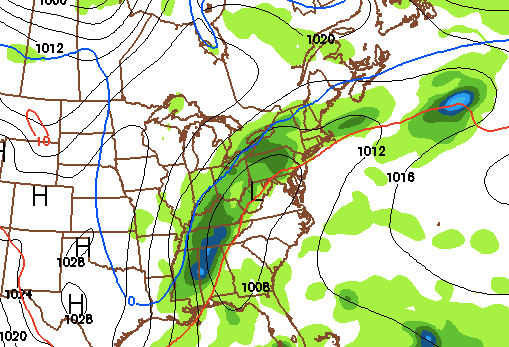
I am currently tracking a major cold front sweeping through the area at the end of next week. This front will bring in arctic air behind it and plunge temperatures into the 30s. There is a small chance that this cold front phases with the jet stream and turns into a Nor Easter. With this scenario, we would receive rain with some back-end snow as cold air is rapidly brought in behind the storm. At this point, this solution is unlikely. I am sure we will have our first frost next weekend, as well as highs in the 40s for a few days after the front pulls through. After this cold stretch of weather, temperatures should rise to more seasonable levels.
Here is the GFS model 247 hours out (Friday October 28th midnight). The blue line represents the rain/snow margin:

