Its coming folks. The largest October snowstorm to hit the area in recorded history is starting to gain steam in the south as the trough begins to phase together. Right now we are dealing with two pieces of energy, one in the Atlantic and one over the Southeast. By tomorrow morning, these two disturbances will phase and explode, creating a massive nor’easter. Winter storm warnings have been issued by the National Weather service for Chester, Bucks, Montgomery County, and Hunterdon. While a winter weather advisory has been issued for Philadelphia, Delaware, Mercer, Camden, and Burlington counties.
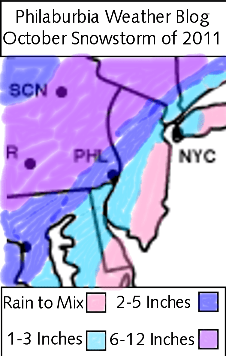
Now, here’s my snow map for this storm (explanation will come after):

Okay, so these are my final totals. Right now, we still do not have the storm’s path nailed down. A small shift east will shift the 6-12 totals into our area, while a shift west will bring the 1-3 totals up.
This storm will not be all snow. It will begin as rain as moisture from the South starts to invade the area. By 2-4 PM, the rain will slowly change to snow as the cold air from the Northwest is brought in by the nor’easter. The key to the amount of snow we receive will be when the changeover to snow occurs. Unfortunately, I, nor any other Meteorologist will be able to pinpoint this time down until it happens. By 8 PM, wet, heavy, snow will be falling north of Philadelphia, weighing down tree branches and power lines. By 4 AM Sunday, the snow should be moving out. Power outages will be major from this storm. Numbers could be in the range we had for Hurricane Irene. Some people, especially to the north, could be out of power for days. The problem for this storm won’t be the roads, but more the tree branches blocking the roads.
Snow Totals: Near the coastal regions, I just do not see the rain changing over to complete snow. From Philadelphia to its immediate south and east, we are looking at 1-3 inches. In the NW suburbs, 2-5 inches will fall. In the Lehigh Valley, Poconos, and Susquehanna Valley, 6-12 inches will fall.
Final Thoughts: Please be careful on the roads Saturday night! Tree branches will be down all over the place. By Sunday, it will look like January in the area. Halloween will be chilly, and there could be still snow on the ground in the NW suburbs. Enjoy trick or treating in the snow, as it may be a while until we have snow on Halloween!
