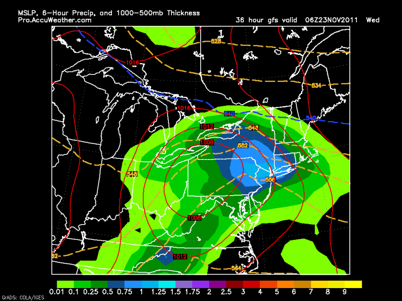
Well, it has been a while since I last posted. The quiet weather pattern we have seen the last few weeks has finally come to an end, for now. A low pressure system will slide to the west of our area Tuesday night into Wednesday, bringing us a substantial rainstorm. Rain totals could approach two inches in some spots.
Heavy rain over the area 1AM Wednesday:

The weather should be cool and sunny for the Thanksgiving parades and the Black Friday rush. High pressure will dominate to our south until another storm system affects the area next Tuesday. This storm should be mostly rain, with maybe some snow as it moves out. More details will surface as we head into the weekend.
In the long-range:…. Dramatic music! The NAO looks to be headed into a more neutral position around Dec 5th. This means that the cold and snowy conditions should start not too far after. There are a few forecasters who do not believe the NAO and AO (Atlantic Oscillation) will be ideal for snow throughout the winter. I disagree with them. I believe our real snow season (the Halloween storm didn’t count) will start December 10th. The long-range forecast models are showing shots of prolonged cold air during this time period, as well as an active pattern. Stay posted!
