Yes, we continue to progress to winter. The National Weather Service has posted a Freeze Watch for tomorrow night. The watch includes all counties north and west of Philadelphia. High temperatures on Friday will reach the mid-60s. A clear night sky will induce radiational cooling, dropping low temperatures at or below 32 degrees early Saturday morning.
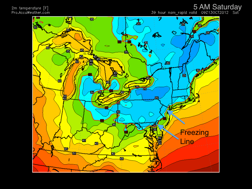
Here is the NAM model. This shows 2m temperatures (6 feet above surface) of the Northeast at 5 AM Saturday. The freezing line stretches down to Philadelphia:

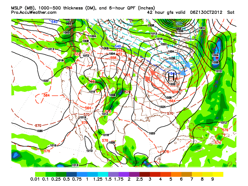
Most computer models are in consensus for this “first freeze.” The NAM and GFS forecast model both show the freezing line creeping all the way to South Jersey early Saturday morning. It shouldn’t stay below freezing for that long as temperatures will escalate near 60 on Saturday. This colder stretch is all in part to a strong high pressure sitting just to our west. Cold air from Quebec is being wrapped around the high and is coming down to the I-95 corridor.
Here is the GFS showing the high pressure just to our west at 2 AM Saturday. I drew arrows representing the cold and warm air to help people visualize the model:

Next week, a warm front followed by a weak cold front will pass through on Monday. After a cooler Tuesday, temperatures should slowly increase into the end of next week before a strong cold front arrives next weekend. The week of 22nd will likely have highs consistently in the 50s and lows near freezing.
Remember: First freeze is coming tomorrow night… put away any small plants for the night, to be safe.
