Hey everyone. I hope it has been a relaxing Thanksgiving for many of you. I have been tracking a very pesky low pressure system that will bring some snow and rain to the area tomorrow. The forecast models have not done a good job with this storm, much like the last nor’easter that busted for most of Philadelphia area.
Every run has seen some sort of evolution with this storm. Last week, the prospects for a minor snowstorm seemed likely. But through the weekend, the forecast models started to lean away from the snowy solution, sliding the storm south and out to sea. However, the last few runs of the short range models have been forecasting a more aggressive system tomorrow. The NAM, in particular, has been showing a good 2-4 inches of snow falling just north and west of the city.
I am sitting on the conservative side right now with this storm. It is still November and the ground is still fairly warm from the fall. I do not expect much accumulation on roads. Some sidewalks and driveways could be covered, especially if dynamic cooling occurs and the snow is falling at night.
A wintry mix should start in the mid-morning and continue into the evening. At some point tomorrow, the mix could change to snow. The earlier the changeover, the more snow we receive.
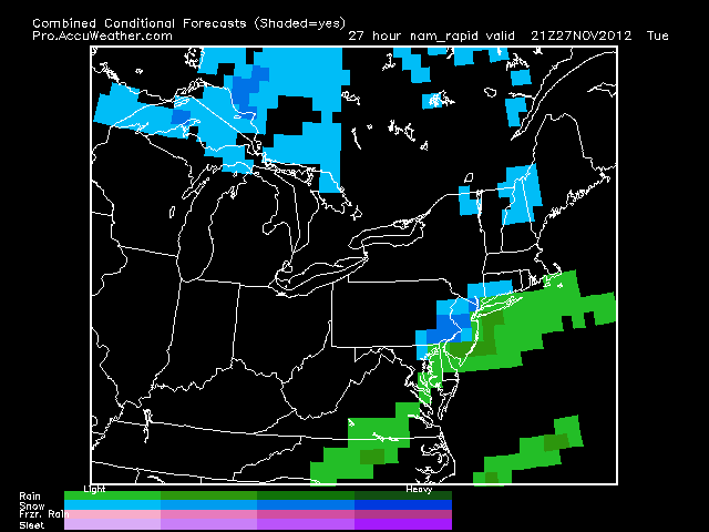
As you can see on the map below, at 4PM, the rain/snow line will be very close to the Philadelphia area. If this line moves south 10 miles, more snow will fall and more accumulation will occur.

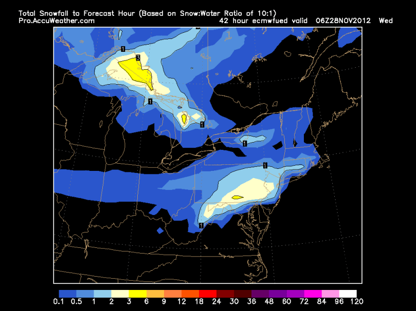
The European model shows a general 1-2 inches of snow to fall by tomorrow late night:

