
Warmer Temperatures
February is opening to an active weather pattern for our region. Over the next 7 days, we will likely be impacted by three different storm systems. During this period, temperatures will be slightly above average as shown by the European anomaly map below:

As the anomaly shows, we are currently in a transition from a negative to positive PNA. What this means is that our reprieve from the cold is likely temporary. Additionally, the Arctic Oscillation is forecast to go negative around the 10-day timeframe. This usually indicates a colder airmass entering the continental US:

7-Day Pattern
Until then, we have four storms to worry about! The first is arriving tonight into tomorrow. This is a system associated with a cold front moving across the Northeast. Temperatures were in the 40s today, but will rapidly drop tonight into tomorrow morning. I expect the rain to eventually change briefly over to snow overnight before moving off the NJ coast. The map below shows the high-resolution model forecast at 3 AM Friday:

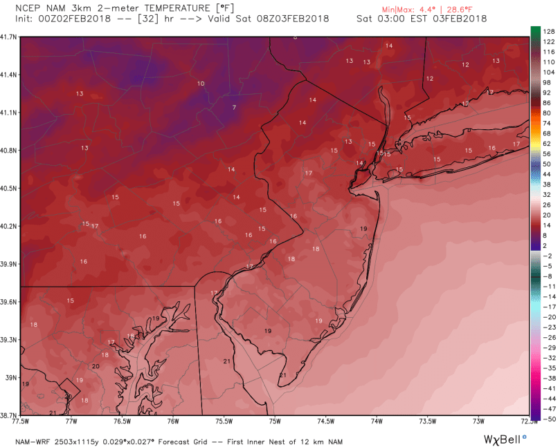
Tomorrow morning’s commute could be slick as wet roads freeze over once the front pulls through. Temperatures will drop during the day on Friday before plunging into the teens with wind chills into the single digits:
Storm #2 will quickly follow the first, forming rapidly during the day on Sunday. This system has characteristics of a coastal, phasing with a northern piece of energy over the great lakes. Models are currently projecting a quick phase, which would push the storm further west and keep our temperatures above freezing. Super Bowl Sunday will likely be a drencher as this storm barrels through the region Sunday evening. Any celebrations following the game (knock on wood!) will be cold and wet, with temperatures around 40 degrees.

Storm #3 is looking like a classic “Appalachian runner.” The storm will form over Missouri next Tuesday before moving Northeast along the Appalachian mountain range. This atmospheric setup will steer the storm to the west and warm up our region. Temperatures could reach the 50s on Wednesday as the storm pulls through.

Our pattern continues to be active following this storm, with another system impacting the region next Saturday.
Stay dry over the coming week! Go Eagles!
