I hope everyone enjoyed the warmth we got today. I actually had the window open in my car driving today! Many records were broken with the highs reaching 72 in Trenton and 69 in Philly. A cold front will sweep through the area tonight and lower the temperatures by 20 degrees.
THEN… it gets complicated. A storm system will pass to the north on Sunday giving us occasional showers. After that nuisance system passes it gets really complex. Another storm will follow it on Tuesday. Its placement actually depends on a trough in the west and how far west it will be sitting during the storm.
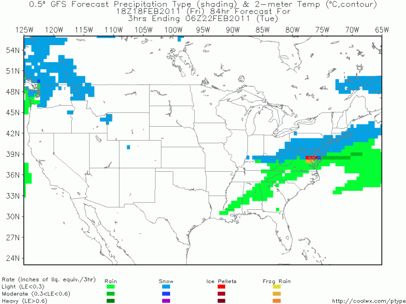
Models are all over place right now and details are a little vague. I’m leaning toward a more snowy solution but anything could change right now. A general 3-6 inches should be the maximum for the Tuesday storm. A minimum looks to be 1-3, so we’re looking at some snow. Another problem is, as we’ve seen before all season, that the storm will pass right during the morning rush on Tuesday. Even if we get only 1-3 inches, the morning rush will be nasty.
Here’s a map of the snow at 1 AM Tuesday Morning:
Temps will be in the 30s on Tuesday, a 40 degree drop from today. Truly amazing.
Temps will rise at the end of next week, then it should get cold and stormy for the beginning of March. Still some winter to go!!

