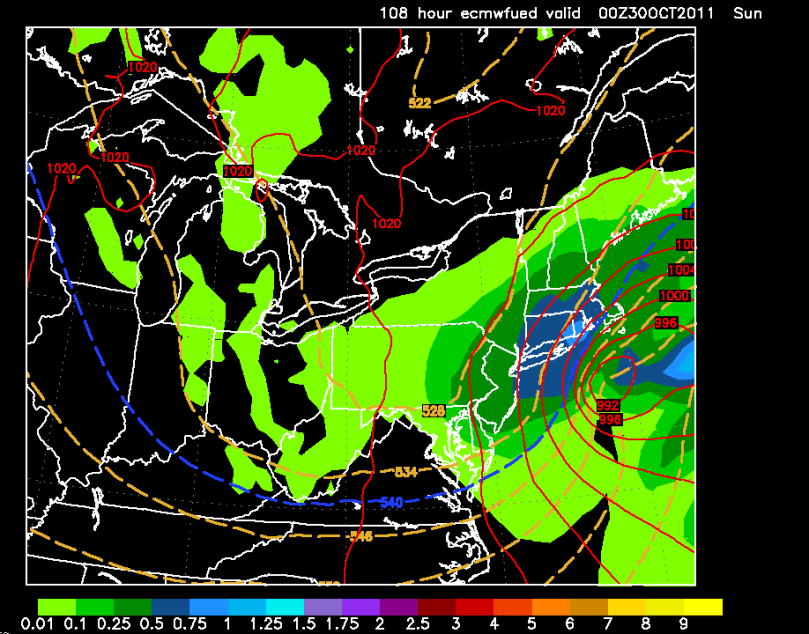
The last few days have been demanding for weather forecasters across the country. October snowstorms are very hard to nail down. Because of their rarity, meteorologists do not have much history to base their predictions off of. This has been the case for our possible nor’easter on Saturday.
Here is how things should pan out until Friday:
A cold front will pass through our area Thursday. Around an inch of rain should fall from this system. After the cold front moves through, it gets complicated. Hurricane Rina (currently in the Caribbean) will start to head toward Florida as the jet stream starts to influence its path. At this point, there are two scenarios (surprise surprise) that could happen.
Scenario 1, Out to Sea – Rina stays strong and does not phase with the jet. Sunny day for the Delaware Valley on Saturday. No nor’easter. This scenario is supported by a few forecast models, including the famous GFS.

Scenario 2, Snowstorm – Rina weakens and phases with the jet, bringing in cold air and becoming a large nor’easter. This solution would likely bring accumulating snow to our region. As of right now, I am leaning toward this scenario. The forecast model supporting this scenario is known to be the most accurate.

Truthfully, I really have no idea what will happen this Saturday. There have not been many October storms to base this prediction on whatsoever. The number of factors involved, combined with the unpredictability of Atlantic tropical systems just adds to the confusion.
As we progress through the week, one of these scenarios will become more and more favored. If the models have complete consensus on scenario 2, then I will proceed to make a snow map as soon as possible. If scenario 1 looks more likely, then I will issue a five-day forecast. I will update tomorrow with the latest.

How much snow would we get??
At this point, this storm is looking to be minor one. A coating to an inch on grassy surfaces at the most.