Stormy February and Another Snowstorm Tomorrow!


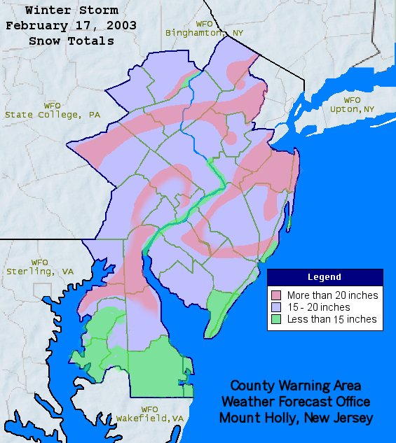
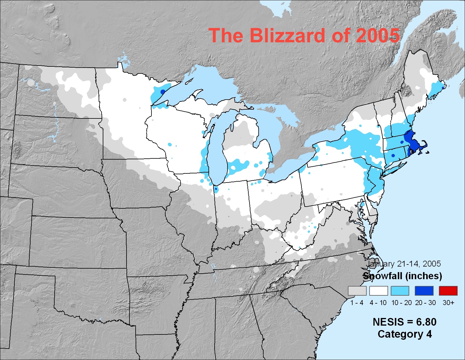
Hi everyone. This has been quite the winter so far. February will mark the transition from a colder and drier pattern to a warmer and wetter one. The next two weeks will be extremely active with multiple threats for snowstorms. While the transition to spring has begun, we still need to get through another few weeks of snowy, stormy weather before the warmer temperatures arrive.

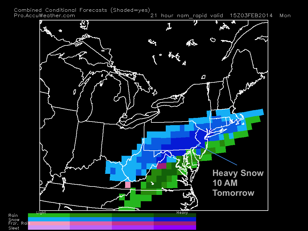
The next storm is expected to arrive tomorrow morning and drop a substantial amount of snow. The system is part of a shortwave coming off of a cold front that will pull through later tonight. The storm will be fast-moving and intense. Heavy snow will fall during the midday hours tomorrow and accumulate a good amount by nighttime. Most models have been projecting a general 6-8 inches with some isolated areas of 8-10. Totals will be held down in South Jersey because of mixing issues.

European Storm Total Projection

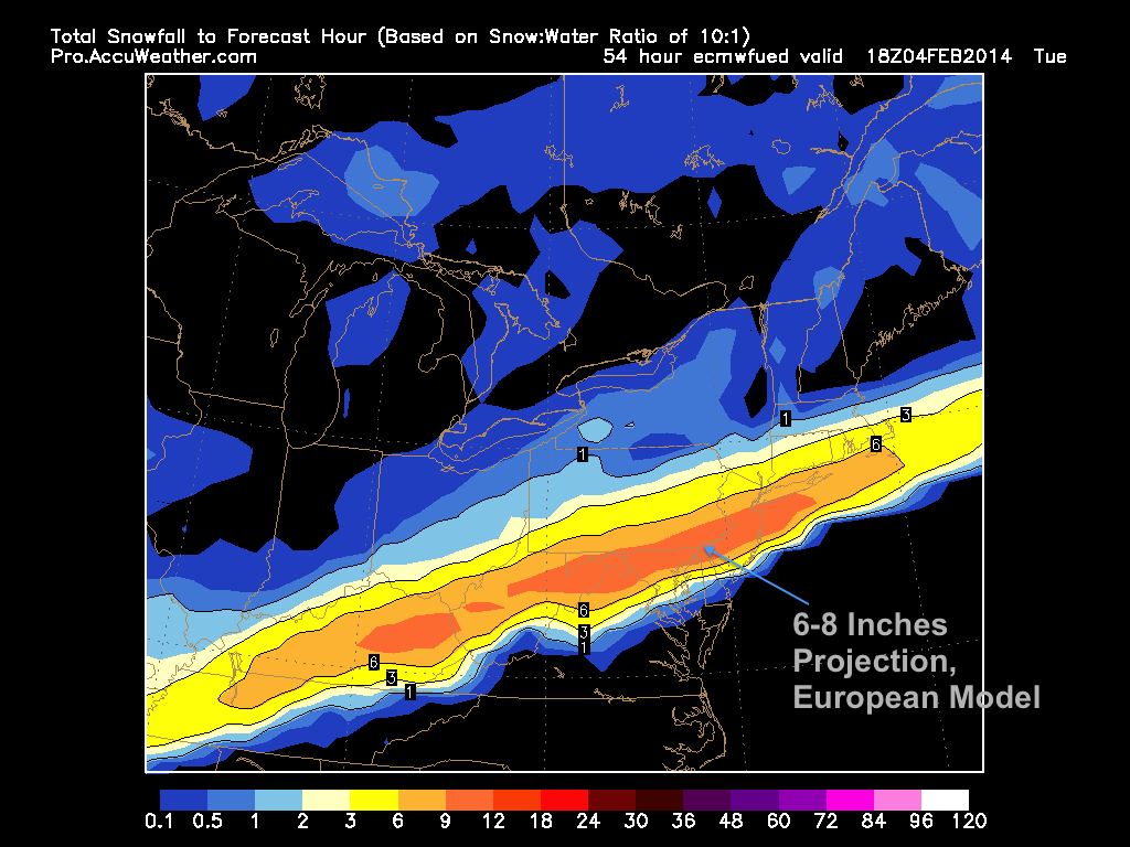
The heaviest snow will arrive around mid-morning and continue into late afternoon before ending abruptly. Because temperatures will be held near freezing, the snowflakes will likely be large, wet, and heavy. I do not recommend driving on the roads during the day on Monday.

Nam snow intensity
Nam snow intensity

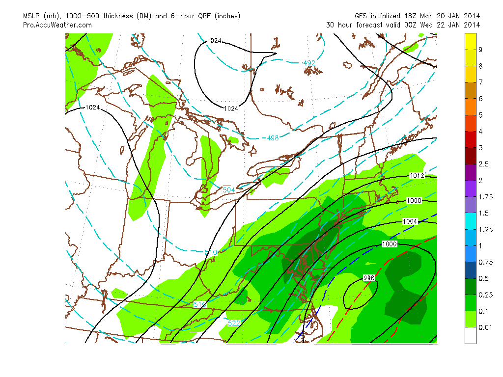
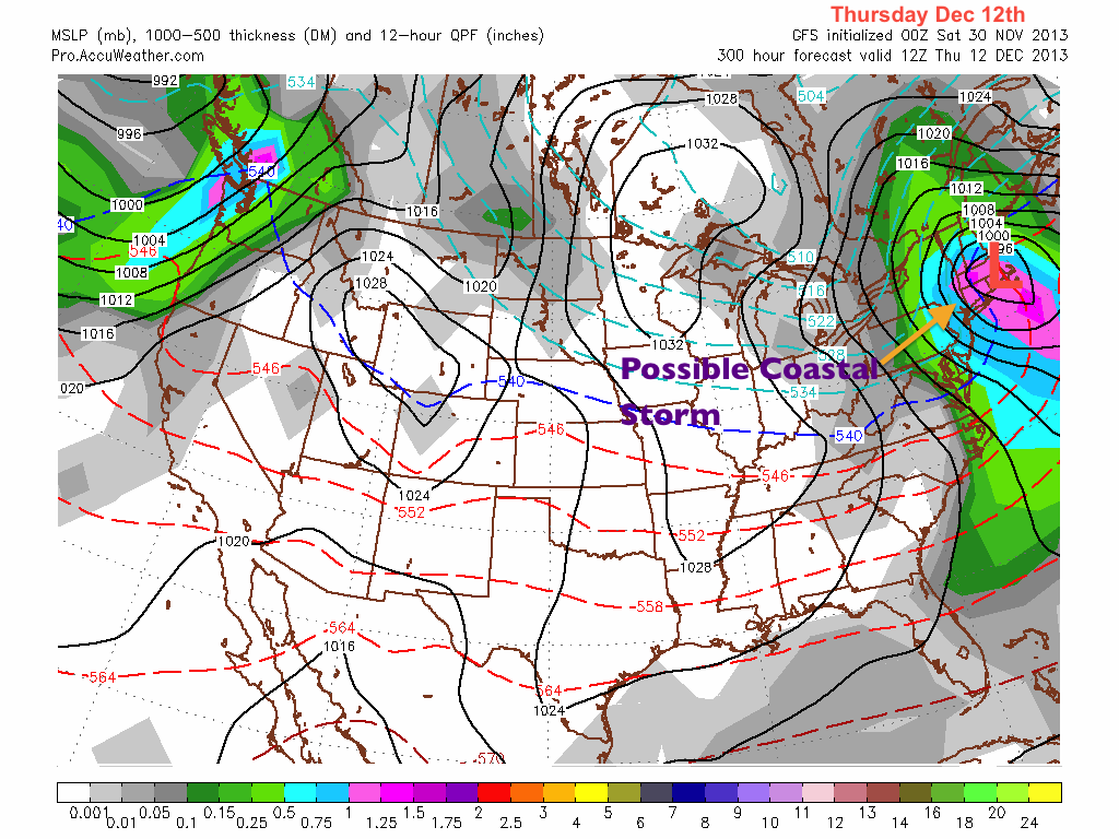
Another, much stronger storm system will threaten the region with ice, rain, and snow on Wednesday. The location of the low pressure will be pivotal in determining the precipitation type for the area. Right now, it is looking more likely than not that we could see some ice accumulation followed by rain. Details will likely change over the next day or two as confidence levels rise.

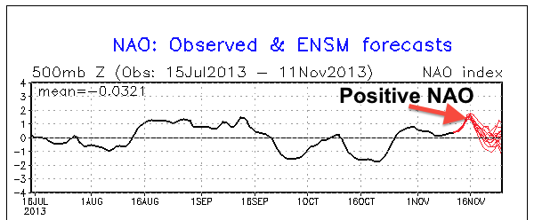
In terms of the current teleconnections, the NAO (North American Oscillation) has been positive for most of the winter and looks to continue to stay positive into mid February.

Positive NAO
Positive NAO

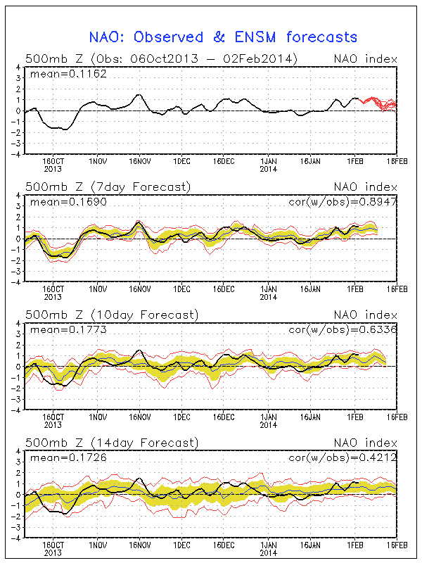
With a positive NAO, the high pressure needed to produce very large nor’easters on the east coast is weakened or absent. For the rest of the winter, expect more quick hitting storms like the one tomorrow. My feeling is that there will likely be one last large storm near the end of the month that will put an end to this chaotic winter we’ve been having.

Until next time…

Snow Map and Forecast for the Mid-January Snowstorm of 2014


Hi everyone. It has been a very interesting 48 hours in terms of the next storm. It was just yesterday when we were looking at a very small clipper system barely affecting the region. Over the past day or two, things have taken a 180 and we are now looking at a major to significant snowstorm affecting most of the northeast.

The forecast models have been showing an Alberta clipper phasing with a piece of energy over the Carolinas later tonight. The resulting storm will amplify off the coast and quickly move northeast. Temperatures will be around 20 degrees, which means snow ratios will be high and salt on the roads will be basically ineffective. The map below shows the GFS model showing the storm strengthening over the Atlantic with heavy snows over the mid-atlantic. This shows the peak of the snow, which will occur from 3-9 PM.

GFS at 7 PM
GFS at 7 PM

Overall, the snow will start around 11 AM tomorrow and end late tomorrow night. The snow will be heavy for an extended period of time, which means that accumulations could be large in many locations. I wouldn’t be surprised to see some reports of 10+ inches in a few isolated areas. Most of the Delaware Valley will receive 6-9 inches with higher totals in the southern and eastern parts of the region. Travel will be horrible tomorrow for most of the day. Stay home.

Snow Map
Snow Map

After the storm pulls through, brutally cold arctic air will arrive. Temperatures will likely not get out of the 20s for the rest of the week, unfortunately. All in all, do not expect our snowpack to melt anytime soon.

Short Review for Post-New Years Snowstorm


Hi everyone. Todays post will be on the shorter side as I am currently blogging from the Caribbean and my Internet connection is very poor.

A storm system will intensify from the southeast and ride up the coast, which will drop a general 4-8 inches of light, puffy snow in the Delaware Valley. Higher totals in excess of a foot will occur in New York and New England.

NAM snow totals
NAM snow totals

This storm will be a fast mover, as there isn’t much blocking ahead of the storm. The snow will likely start later Thursday night and end by Friday afternoon. Because the temperatures will be in the teens during the storm, snow ratios will be high and the snow will accumulate very rapidly.

Travel on Friday will be poor and winds will be fairly high during the storm. There will likely be massive airport delays in Friday morning during the height of the storm. Many schools will likely be closed as well. After the snow, another system will affect the region on Sunday/Monday. This storm looks to be primarily rain at this point.

Happy New Year everyone!

A Tricky Forecast for the Upcoming Snowstorm on Saturday


UPDATE: 3:45 PM Friday

No significant changes in my forecast for tomorrow. There has been some model waffling, however, which shows that there could be a few surprises tomorrow when the storm arrives. I am sticking with a general 2-4 inches in the Philadelphia metro area with higher totals further north and west from the city. The snow should also turn to a mix in most areas by late Saturday night.


Hey everybody. Well, another fairly large storm will affect the area on Saturday! The question that remains, especially for the big cities along I-95, is what precipitation type we will receive.

A low pressure system will move through the midwest tomorrow before transferring to the coast sometime on Saturday. The problem for many models and forecasters alike is determining when this transfer occurs. An earlier transfer means more cold air will be brought in behind the storm, meaning more snow for our region. A later transfer means that more warm air will move in aloft and at the surface, meaning more mixed precipitation for the region.

Split Screen GFS
Split Screen GFS

All models are in a general consensus, but with a storm like this, small changes mean large differences in precipitation type. Snow will move in around Saturday 3 PM and continue into the night. Depending on when the transfer occurs, the snow will change over to a mix for areas around I-95 by midnight on Sunday. This changeover to mix could happen later or not even occur if the storm transfers earlier.

Right now, I am taking a conservative approach toward this system. I am calling for 1-3 inches for areas along I-95 with the cutoff being very sharp as one heads further north and south. Allentown could receive 6-8 inches while Doylestown could only receive 1-3. Here is my snow map for the upcoming storm, enjoy!

Snow Map for the 2nd December Storm of 2013

After a Surprise Snowstorm Yesterday, Another Snowstorm is Coming Tomorrow!


Wow. It was quite the day meteorologically yesterday. After many forecast models were showing minimum snow falling in the Delaware Valley, Philadelphia International ended up with 8.6 inches of snow. Many areas to the south and west of the city received 4-8 inches of snow with some isolated totals nearing a foot! Unfortunately, many people were not expecting a major snowstorm to occur. As a result, many accidents were reported on major roadways. December can be a very tricky month to predict snowstorms, as we are still transitioning to a classic winter pattern.

Nice Shot of the Snow Yesterday
Nice Picture of the Snow Yesterday

Another, more predictable snowstorm is in the works for tomorrow. The system is a weak piece of energy associated with the trough that is pulling through the area as we speak. The snow will be short and intense.  The snow will start around 9 AM on Tuesday and end by 7 PM on the same day. In localized areas, snow could fall at an inch or two per hour.  The tricky part of this forecast is determining the exact position of the trough when the moisture runs the coast. Unfortunately, this part of the forecast is subject to “nowcasting”, which means it is impossible to predict which areas will receive the most snow until the storm is actually occurring.

GFS Solution Tuesday Afternoon

Luckily, most models are in agreement that we will receive a general 3-6 inches in the Philadelphia metro area, with lower totals in the outskirt suburbs. Temperatures should hover around 32, and roads should be salted before the storm arrives. A Winter Storm Warning has also been released by the National Weather Service for the whole I-95 corridor.

With that said, here is my first snow map of the 2013-2014 winter. Enjoy!

Snow Map for Mid-December Storm of 2013

Another storm is on-deck for early next week, so stay tuned!

Small Disturbance on Tuesday, Warm Up Late Next Week


Hey everyone. Hope you all had a very relaxing Thanksgiving and Black Friday.

Our pattern is starting to transition toward winter. We are starting to see larger coastal storms (last Tuesday and Wednesday) affecting the Northeast and our high temperatures are starting to stabilize in the 40s. Our weather for the upcoming week is a little odd. Forecast models have been showing a weak low pressure out in the Atlantic, which has the possibility of spinning some precipitation into our area. Any precip that falls will likely be in the form of rain, as the storm will not have enough dynamics to bring in abundant cold air.

Small Disturbance
Small Disturbance

On Friday, temperatures will warm up into the upper 50s or low 60s in front of a cold front. After this front moves through, expect temperatures to drop back into the 30s with a few flurries possible next Sunday and Monday.

Long Range Analysis:

In the long-range, I am currently watching a possible coastal storm with snow implications on December 11th-14th. Many of the forecast models have been hinting at a strong low moving near or along the coast around this time frame. Right now, details are unclear including if temperatures will be low enough to support snowfall in the region. Mid-December historically tends to be the beginning of the large snowstorms in the Philadelphia area. As a result,  I will be keeping a very keen eye on this system this week and next.

Long-Range Coastal
Long-Range Coastal

First Snow Tomorrow Morning; Coating on Grassy Surfaces Likely


An arctic front will bring us our first snowfall of the year overnight tonight into tomorrow morning. Late last week, I was tracking a nor’ easter that could have formed along this arctic front. However, because of the positive trough and positive NAO (North Atlantic Oscillation, which affects where storms form and strengthen on the eastern seaboard) in place, this storm will form far out in the Atlantic. We will likely see many more opportunities for a nor’ easter to form along the coast as the NAO becomes negative and arctic air starts to drop down from Canada later this winter.

Positive NAO = Out to Sea

As a result of the arctic front, it will be very cold tomorrow with highs probably not getting out of the 30s. When precipitation starts later tonight, it will likely be as all rain. As the front progresses through the area, this rain will likely mix with snow then turn to all snow for a short time. Accumulations will likely be just a coating on grassy surfaces.

Projected Snow Accumulation by the North American Model
All snow 7 AM Tuesday

After the snow ends around midday tomorrow, a cold wind will prevail from the Northwest, making temperatures feel like they are in the 20s. Eventually, high pressure will set up to our East, bringing more seasonal temperatures back for the weekend. Another system looks to be in the works for next Monday. The likely precipitation type will be rain from this system. Until next time….

Continued Fall Pattern into Mid November; Winter of 2002-2003 Discussion


Hey everyone. As I sit and write this post, temperatures are plunging below freezing in many areas. Low temperatures tonight will likely dip into the 20s. As a result, tomorrow morning will be very chilly with high temperatures only reaching the mid to upper 40s!

Except for a much earlier sunset, this week will be very, very similar to last. Temperatures will rise into the upper 60s as another low pressure passes to the northeast and brings in warm air ahead of a cold front. Thursday night will likely be rainy with temperatures dropping back into the lower 50s by Friday.

Similar Pattern as Last Week

As we get to the long-range, temperatures look to stabilize in the upper 50s for the week of the 11th before another system comes in later in that week.

Long Range Discussion Series Part 2: Winter of 2002-2003

The winter of 2002-2003 will be the second analog season I will analyze for my upcoming winter forecast of 2013-2014. In terms of El Niño strength, this particular winter had a strong one, stronger than what models are showing for the upcoming winter. It can still be considered an analog winter because the summer of 2002 was neutral between El Niño and La Niña, much like the summer of 2013.

Once again, like the winter 1977-1978, temperatures were below average for the Eastern part of the country. There was a widespread negative anomaly of 2-4 degrees for this winter. Another analog winter shows below average temperatures. Unlike what I said a few posts ago about the 2013-2014 winter being warmer than average, the analogs have proven me wrong. As of right now, I am obviously starting to lean toward a colder than average winter.

2002-2003 Temp Anomalies

Precipitation anomalies were also above average for the Eastern seaboard, similar to the anomalies of 1977-1978. Countrywide, precipitation values seem to be more volatile than temperature. As you can see on the image, there is a substantial difference of precipitation between the eastern states and the midwest. What this shows me is that predicting general precipitation trends will be a difficult task. Our precipitation total will really depend on how many big storms affect us this winter, which brings us to…..

Precip anomalies 2002-2003

Probably the most memorable event from 2002-2003:  the famous Presidents Day Blizzard. This massive storm dropped over 20 inches to widespread areas between Philadelphia and Eastern West Virginia (including Baltimore). Much like the blizzard of 1978, this storm shut down major cities for days and paralyzed much of the infrastructure around these centers. This once again supports my thinking that a significant blizzard will be coming at some point this winter.

President's Day Blizzard Totals
President’s Day Blizzard Totals

Warm Up Next Week and I Analyze the Analog Winter of 1977-1978


Hey everyone. Fall has arrived with a bang as temperatures have been up to fifteen degrees below normal in some places. As I mentioned last Thursday, our first frost will likely be tonight or tomorrow night as nighttime temperatures drop near the freezing point.

Temperatures should stay in the low 50s through the weekend and into the beginning of next week. A low pressure will then start to gain steam over the Plains states and move northeast across Illinois and into Canada. This will cause a small warm up for our area late next week. The warmth will be accompanied by rain and cloudy skies, which will put a damper on any hopes of a few nice October days. Into the week of November 4th, the cold front associated with the low pressure will cross the area, bringing temperatures back around 50 degrees for the rest of the remaining week.

Late Week Rain Followed by Chilly Weather

Overall, expect below average temperatures with one day of rain (next Friday) over the next week and a half.

Long Range Discussion Series Part 1: 1977-1978 Analog

The first analog winter I will discuss is the snowy and cold 1977-1978 winter season. During this period, a weak El Niño was active, which is similar to what kind of Niño will see this upcoming winter. First, I will cover the temperature anomalies, which are slightly surprising. Most of the United States was far below normal for the 1977-1978 season, with the core of the cold in the Great Lakes region. In the Northeast, temperatures ran about 2-4 degrees below normal.

1977-1978 Temp Anomalies

In terms of El Niño strength, this makes sense. A strong El Niño will tend to bring warmer than average temperatures while a weak one will tend to have more unpredictable results. What does this analog tell us about this coming winter? Not too much. However,  it does make me a little suspicious of my original prediction of a warmer than average winter. As I analyze more analog winters, my winter forecast will likely change.

In terms of precipitation during the winter of 1977-1978, the mid-atlantic states received 6-8 liquid equivalent inches above normal! This winter was headlined by the infamous Blizzard of 1978, which dropped 30 inches of snow on Boston and over a foot from NYC to Baltimore. This particular winter demonstrates one outcome of a weak El Niño in the continental United States. If the other analog winters show similar patterns in terms of temperature and precipitation anomalies as 1978, then we could be in for a cold and stormy winter.

Blizzard of 1978
Blizzard of 1978

My next update will analyze the winter of 2002-2003 (Presidents Day Storm) and talk more about our upcoming weather in November.

Till then,

JHirsch

Revival: 2013 Edition. What’s in Store for this Winter?


Prologue:

After a looooong hibernation/break/vacation/furlough, Philaburbia Weather Blog is back! It has been over 8 months since my last post, and frankly, I am excited to be back in the blog seat. Since my last post, there have been tragedies (RIP Tim Samaras), severe weather, wildfires, floods, and a government shutdown (which has limited my resources immensely for this blog…sad face):

NOAA shutdown
NOAA shutdown…noooooo

With that said, Philaburbia Weather is back! To all my readers, I will continue  to produce the most accurate forecasts in the Delaware Valley. I will not let you down. Promise.

Now, let’s get to the weather!!

Chapter 1: Hurricane Discussion

The 2013 hurricane season has been a quiet one.  We have had eleven named storms (which is normal),  two hurricanes, and no major hurricanes. We have seen in recent years how difficult it is to predict hurricane activity each year. Most sources were calling for 8-9 hurricanes with 3-5 major hurricanes and a heightened risk of a US impact. So far, none of these predictions have proved accurate and it does not look like a tropical system will be affecting us in the near future.

Chapter 2: Short Range Discussion

Volatile temperature changes are the big story for the upcoming week. While not unusual for this time of year, we are expecting a 20 degree drop in temperature between today and next Thursday! Before this temperature change, however, some weak disturbances will be pulling through the area Thursday night and Saturday night.

By next Tuesday, a low pressure will form over the great lakes and start to move east. Behind the front associated with the low, unseasonably cold air will follow. The european forecast model depicts this scenario:

Euro 2 PM Oct 22
Euro 2 PM Oct 22

After this front pulls through with minimal precipitation, high temperatures will drop into the low 50s in the day and around freezing at night. This means the northern and western suburbs could receive their first frosts by next weekend. Enjoy the fairly warm for the rest of this week and weekend because….. winter is coming (cue Game of Thrones music)!

Chapter 3: Long Range Discussion

The essential question brought up each fall vexes me every year: How much snow are we getting this winter? Well, it is extremely hard to pin-point exact totals for any location. It is also extremely difficult to predict temperature and precipitation patterns for the upcoming winter. My theory for this failure in forecasting is lack of recorded data. We just do not have enough precedents to be able to successfully predict what will happen each winter.

But,

I will attempt to relate past winters in terms of the upcoming weak El Niño period this year. Technically called analog winters, these past seasons have had a similar El Niño as we will have for winter 2013-2014.  Using some data from the Climate Prediction Center, I have concluded that a handful of analog winters could be considered: 1968-1969, 1976-1977, 1977-1978, 2002-2003, 2004-2005. Coincidentally, every single one of these analog seasons have been above normal and have had a major snowstorm affect the Northeastern US. What does this mean for this winter? My call for the winter of 2013-2014 is a warmer than average winter with one large snowstorm for the northeast. Put it down in the books.

By the way, here’s a snowfall total map for the blizzard of 2005, which dropped over a foot of snow in the Philadelphia region:

Blizzard of 2005
Blizzard of 2005

Epilogue:

Next post will deal with more discussion of the analog winters as well as the possibility for the first flurry (oh boy oh boy) in early November. If you have any feedback, comment. Like my Facebook page: https://www.facebook.com/pages/Philaburbia-Weather/125766690824958. Also tell your friends that the blog is back… spread the word.

Till next time,

JHirsch