Snow Map for the Clipper Storm on Tuesday


Hi everyone, its Jason Hirsch.  It looks like this clipper storm will be giving us a general 3-6 inches of snow. I lowered the totals because it now looks like we may get a wintry mix for a time during the storm. I am still not sure how this storm will play out  because the weather models have been placing the low all over the place recently.

Here is my guess of how this storm will affect the area: Expect the snow to arrive Monday night at around 9:30. At times overnight the snow will become steady. It should be out of the area by 2:00 PM Tuesday. This is nothing compared to what we just had on Wednesday, but will still be troubling for the morning commute on Tuesday. Will students get off from school Tuesday? I have a feeling most schools will be delayed. In the areas with the most snow I would expect most schools in that area to be shut down for the day….

Here is the snow map I made for the storm. Note that this map is just my opinion:

Clipper Storm Snow Map

A winter storm watch has also been issued for counties north of Philadelphia. Here is the map of that from NOAA:

Winter Storm Watch Map

What is an Alberta Clipper?


Well, seeing as our area will be affected by an Alberta clipper, it seems fit to explain what exactly an Alberta clipper is. As indicated by the name, Alberta clippers come from…… Alberta!!! Well, not always, but they come all the way from the north of Canada. These storms generally have high snow ratios and generally dump their heaviest snow over the midwest. However, this one may be different. This Alberta clipper will wind itself up off the coast and likely bring its heaviest snow on, or just west of (depending on the track) the I-95 corridor.

Forecast for Sunday February 14th


Hello everyone, the clipper storm is coming up fast to give most of the area north of Philadelphia a nice 4-7 inches of the white stuff. Now to the forecast:

Tonight: Partly cloudy skies and cold. Watch for refreeze. Low 21

Tomorrow: Partly cloudy with a few peaks of sunshine Hi 32

Tomorrow Night: Becoming mostly cloudy late. Low 16

Monday: Mostly cloudy throughout the day watch for snow north of Philadelphia, wintry mix south. Hi 31 Low 24

Tuesday: Snow winds down by noon. Then clearing up by nighttime Hi 31 Low 20

Coming later tonight: What is a Clipper storm by correspondent Brett

3 Day Forecast for Saturday February 13th


After talking with Philaburbia correspondent Brett, we decided that a good 4-8 inches is a nice prediction for Monday Night’s storm. Now here’s the forecast:

Tonight: Clear and cold Low 17

Tomorrow: Partly to Mostly Cloudy Hi 31

Tomorrow Night: Becoming clear late Low 22

Sunday: Sun and clouds throughout the day Hi 34 Low 20

Monday: Becoming mostly cloudy in the morning with snow from the clipper system arriving in the evening Hi 30 Low 21

Coming up tomorrow: A new poll, an explanation of a clipper and the three day forecast

About Monday Night/Tuesday Snowfall


Well, we’re at that time again…another storm looks to be in eyesight for Monday Night. This one won’t be nearly as big as the last two. It is a “clipper” system which will ride through the midwest and wrap itself up off the New Jersey coast as a coastal storm. Right now, the strength and placement of this storm are in question. If the storm goes more to the south, we’ll only see 3-6 inches. If it comes close enough to the area, expect 6-10 inches of the white stuff. I am leaning more toward 6-10 right now, but you never know what may happen. Here is a preliminary snowmap I made for the area. It just outlines where snow will most likely fall:

Snowfall Map for Monday Night into Tuesday

Let me note to all kids out there that it MAY be possible that schools will close Tuesday giving some of you 7 day weekends (Wednesday, Thursday, Presidents Day long weekend, & Tuesday)

Jim Kosek: Accuweather’s “CRAAZY” Weatherman


I have to give credit to yahoo.com for reminding about Jim Kosek, a meteorologist who works for accuweather.com. His primary job on the site is to report 90 second forecasts for cities and regions all over America. Me? I discovered that watching him can be an informative, yet hilarious way of finding out the weather.  The great part is that almost 100 percent of his forecasts are filled with screaming or using some sort of wacky prop, so you’ll never be bored watching him. Here are two of his videos:

This one is from a week ago for the storm last Saturday for Baltimore :

This one is from two days ago for the storm we just had:

His webpage on Accuweather.com can be found here: http://www.accuweather.com/video-on-demand.asp?channel=KOSEKJ&title=The%20Jim%20Kosek%20Channel

ENJOY!

3 Day Forecast for Friday Feb 12th


It was a beautiful day today, not a cloud in the sky. Some people around the area have almost three feet of snow on the ground from this past storm and the February 6th storm. Even though the next few days will be bitterly cold, the sun will help melt the snowpack slowly and steadily, preventing any flooding issues around the area. Now to the forecast:

Tonight: Clear skies and cold Low 18

Tomorrow: Another beautiful day in the making, still a little breezy Hi 32

Tomorrow Night: Clear skies Low 19

Saturday: A low pressure system passes South of us, clouds shouldn’t make it to the coverage area. Hi 30 Low 18

Sunday: Sunny with a few high clouds. Becoming partly cloudy at night. Hi 33 Low 20

Coming up later tonight: Clipper system passes through the area Monday, Jim Kosek, and NAO values

Epic Storm Story from Brett’s House


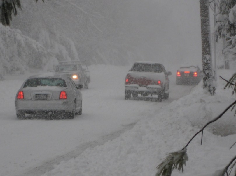
Yesterday was a wild day across the area. I actually got out and walked around a bit with my dad and sister and we witnessed the wrath of this storm first-hand. First of all, we saw a car go slipping and sliding down the road into a snow drift. While my dad was trying to push the car out of the drift, I noticed that a large branch had fallen on a transformer box and was on fire. Shortly after, it exploded in a shower of colorful sparks and flame. This marked the beginning of a 20 hour period in which we did not have power. In fact, we only just got power at 11:00. Although I don’t have a yardstick to out and measure the snow with, I think I got about 20 inches. That’s all from me, for now.

Snow Bound Car
Snow Canyon Path

Aftermath and Recap of Wednesday Storm


I only have one word to say about this storm: WOW. There were hundreds of thousands of power outages around the area and area highways were closed to public traffic. Winds are still howling here, I officially measured 18.8 inches of snow (average because of snow drifts). Every school in our coverage are closed and many driveways still haven’t been plowed yet. After hearing a few stories about people getting stuck and losing power for the whole night, I have concluded that this storm will be remembered for many years to come.

Here are the top 10 totals from around the area:

1. East Nanmeal in Chester Co. – 26.8 inches

2. South Coventry in Chester Co. – 26.1″

3. Willistown in Chester Co. – 24.0″

4. Eagleville in Montgomery Co. – 23.0″

5. Montgomeryville in Montgomery Co. – 22.4″

6. Abington in Montgomery Co. – 22.3″

7. Trappe in Mont Co. – 22.0″

8. Ridley Park in Delaware Co. – 21.5″

9. Perkasie in Bucks Co. – 21.0″

10. Sellersville in Bucks Co. 21.0″

Note that the top total in NJ was Ewing in Mercer County with 18.7 inches of snow.

Also note that Philadelphia reached a snowfall record of 72.1, beating their old snowfall by 7 inches.

Coming Later Today: Forecast, comment from Brett (if he has power), and looking toward the next storm